Yvrencheux
Yvrencheux (French pronunciation: [ivʁɑ̃ʃø]) is a commune in the Somme department in Hauts-de-France in northern France.
Yvrencheux | |
|---|---|
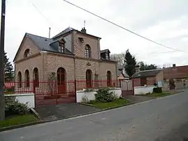 The town hall in Yvrencheux | |
 Coat of arms | |
Location of Yvrencheux | |
 Yvrencheux  Yvrencheux | |
| Coordinates: 50°10′56″N 1°59′35″E | |
| Country | France |
| Region | Hauts-de-France |
| Department | Somme |
| Arrondissement | Abbeville |
| Canton | Rue |
| Intercommunality | Ponthieu-Marquenterre |
| Government | |
| • Mayor (2020–2026) | Thierry Miannay[1] |
| Area 1 | 6.01 km2 (2.32 sq mi) |
| Population | 124 |
| • Density | 21/km2 (53/sq mi) |
| Time zone | UTC+01:00 (CET) |
| • Summer (DST) | UTC+02:00 (CEST) |
| INSEE/Postal code | 80833 /80150 |
| Elevation | 73–119 m (240–390 ft) (avg. 142 m or 466 ft) |
| 1 French Land Register data, which excludes lakes, ponds, glaciers > 1 km2 (0.386 sq mi or 247 acres) and river estuaries. | |
Geography
Yvrencheux is situated 10 miles (16 km) northeast of Abbeville, on the D256a road
Population
|
| ||||||||||||||||||||||||||||||||||||||||||||||||||||||||||||||||||||||||||||||||||||||||||||||||||||||||||||||||||||||||||||||||||||||||||||||||
| Source: EHESS (1793-1999)[3] and INSEE[4] | |||||||||||||||||||||||||||||||||||||||||||||||||||||||||||||||||||||||||||||||||||||||||||||||||||||||||||||||||||||||||||||||||||||||||||||||||
See also
References
- "Répertoire national des élus: les maires" (in French). data.gouv.fr, Plateforme ouverte des données publiques françaises. 13 September 2022.
- "Populations légales 2020". The National Institute of Statistics and Economic Studies. 29 December 2022.
- Des villages de Cassini aux communes d'aujourd'hui: Commune data sheet Yvrencheux, EHESS (in French).
- Population en historique depuis 1968, INSEE
Wikimedia Commons has media related to Yvrencheux.
This article is issued from Wikipedia. The text is licensed under Creative Commons - Attribution - Sharealike. Additional terms may apply for the media files.