Ronssoy
Ronssoy (French pronunciation: [ʁɔ̃swa]) is a commune in the Somme department in Hauts-de-France in northern France.
Ronssoy | |
|---|---|
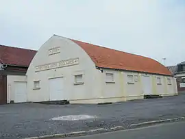 The town hall in Ronssoy | |
Location of Ronssoy | |
 Ronssoy  Ronssoy | |
| Coordinates: 49°58′58″N 3°09′38″E | |
| Country | France |
| Region | Hauts-de-France |
| Department | Somme |
| Arrondissement | Péronne |
| Canton | Péronne |
| Intercommunality | Haute Somme |
| Government | |
| • Mayor (2020–2026) | Michel Bray[1] |
| Area 1 | 7.53 km2 (2.91 sq mi) |
| Population | 586 |
| • Density | 78/km2 (200/sq mi) |
| Time zone | UTC+01:00 (CET) |
| • Summer (DST) | UTC+02:00 (CEST) |
| INSEE/Postal code | 80679 /80740 |
| Elevation | 100–147 m (328–482 ft) (avg. 149 m or 489 ft) |
| 1 French Land Register data, which excludes lakes, ponds, glaciers > 1 km2 (0.386 sq mi or 247 acres) and river estuaries. | |
Geography
Ronssoy is situated 11 miles (18 km) north of Saint-Quentin, on the D6 road
Population
| Year | Pop. | ±% p.a. |
|---|---|---|
| 1968 | 696 | — |
| 1975 | 636 | −1.28% |
| 1982 | 654 | +0.40% |
| 1990 | 624 | −0.59% |
| 1999 | 612 | −0.22% |
| 2007 | 537 | −1.62% |
| 2012 | 579 | +1.52% |
| 2017 | 587 | +0.27% |
| Source: INSEE[3] | ||
See also
References
- "Répertoire national des élus: les maires" (in French). data.gouv.fr, Plateforme ouverte des données publiques françaises. 13 September 2022.
- "Populations légales 2020". The National Institute of Statistics and Economic Studies. 29 December 2022.
- Population en historique depuis 1968, INSEE
Wikimedia Commons has media related to Ronssoy.
This article is issued from Wikipedia. The text is licensed under Creative Commons - Attribution - Sharealike. Additional terms may apply for the media files.