Guillaucourt
Guillaucourt (French pronunciation: [ɡijokuʁ]) is a commune in the Somme department in Hauts-de-France in northern France.
Guillaucourt | |
|---|---|
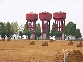 Water towers in Guillaucourt | |
Location of Guillaucourt | |
 Guillaucourt  Guillaucourt | |
| Coordinates: 49°50′34″N 2°37′56″E | |
| Country | France |
| Region | Hauts-de-France |
| Department | Somme |
| Arrondissement | Péronne |
| Canton | Moreuil |
| Intercommunality | CC Terre de Picardie |
| Government | |
| • Mayor (2020–2026) | Ludovic Kusnierak[1] |
| Area 1 | 6.37 km2 (2.46 sq mi) |
| Population | 400 |
| • Density | 63/km2 (160/sq mi) |
| Time zone | UTC+01:00 (CET) |
| • Summer (DST) | UTC+02:00 (CEST) |
| INSEE/Postal code | 80400 /80170 |
| Elevation | 52–96 m (171–315 ft) (avg. 87 m or 285 ft) |
| 1 French Land Register data, which excludes lakes, ponds, glaciers > 1 km2 (0.386 sq mi or 247 acres) and river estuaries. | |
Geography
Guillaucourt is situated 16 miles (26 km) southeast of Amiens at the D165 and D136 junction and very close to the A29 autoroute.
Population
| Year | Pop. | ±% p.a. |
|---|---|---|
| 1968 | 340 | — |
| 1975 | 323 | −0.73% |
| 1982 | 302 | −0.96% |
| 1990 | 296 | −0.25% |
| 1999 | 305 | +0.33% |
| 2007 | 382 | +2.85% |
| 2012 | 396 | +0.72% |
| 2017 | 440 | +2.13% |
| Source: INSEE[3] | ||
See also
- Communes of the Somme department
- Guillaucourt station, a former railway station
References
- "Répertoire national des élus: les maires". data.gouv.fr, Plateforme ouverte des données publiques françaises (in French). 2 December 2020.
- "Populations légales 2020". The National Institute of Statistics and Economic Studies. 29 December 2022.
- Population en historique depuis 1968, INSEE
Wikimedia Commons has media related to Guillaucourt.
This article is issued from Wikipedia. The text is licensed under Creative Commons - Attribution - Sharealike. Additional terms may apply for the media files.