Rumigny, Somme
Rumigny (French pronunciation: [ʁymiɲi]) is a commune in the Somme department in Hauts-de-France in northern France.
Rumigny | |
|---|---|
 Rumigny manor | |
Location of Rumigny | |
 Rumigny  Rumigny | |
| Coordinates: 49°48′29″N 2°16′50″E | |
| Country | France |
| Region | Hauts-de-France |
| Department | Somme |
| Arrondissement | Amiens |
| Canton | Amiens-6 |
| Intercommunality | Amiens Métropole |
| Government | |
| • Mayor (2020–2026) | Dominique Evrard[1] |
| Area 1 | 7.83 km2 (3.02 sq mi) |
| Population | 644 |
| • Density | 82/km2 (210/sq mi) |
| Time zone | UTC+01:00 (CET) |
| • Summer (DST) | UTC+02:00 (CEST) |
| INSEE/Postal code | 80690 /80680 |
| Elevation | 79–125 m (259–410 ft) (avg. 115 m or 377 ft) |
| 1 French Land Register data, which excludes lakes, ponds, glaciers > 1 km2 (0.386 sq mi or 247 acres) and river estuaries. | |
Geography
Rumigny is situated some 6 miles (10 km) south of Amiens, on the D75 road.
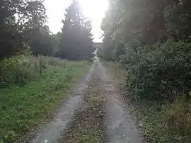
The manor house, Chateau de Rumigny, is set in woodland to the west of the village centre.
Population
| Year | Pop. | ±% p.a. |
|---|---|---|
| 1968 | 332 | — |
| 1975 | 424 | +3.56% |
| 1982 | 476 | +1.67% |
| 1990 | 529 | +1.33% |
| 1999 | 567 | +0.77% |
| 2007 | 580 | +0.28% |
| 2012 | 559 | −0.73% |
| 2017 | 611 | +1.79% |
| Source: INSEE[3] | ||
See also
References
- "Répertoire national des élus: les maires". data.gouv.fr, Plateforme ouverte des données publiques françaises (in French). 2 December 2020.
- "Populations légales 2020". The National Institute of Statistics and Economic Studies. 29 December 2022.
- Population en historique depuis 1968, INSEE
External links
Wikimedia Commons has media related to Rumigny (Somme).
- Official commune website (in French)
This article is issued from Wikipedia. The text is licensed under Creative Commons - Attribution - Sharealike. Additional terms may apply for the media files.