Guerbigny
Guerbigny (French pronunciation: [ɡɛʁbiɲi]; Picard: Guérbigny) is a commune in the Somme département in Hauts-de-France in northern France.
Guerbigny | |
|---|---|
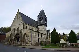 The church in Guerbigny | |
Location of Guerbigny | |
 Guerbigny  Guerbigny | |
| Coordinates: 49°42′03″N 2°39′40″E | |
| Country | France |
| Region | Hauts-de-France |
| Department | Somme |
| Arrondissement | Montdidier |
| Canton | Roye |
| Intercommunality | CC Grand Roye |
| Government | |
| • Mayor (2020–2026) | Maryline Desprez[1] |
| Area 1 | 8.27 km2 (3.19 sq mi) |
| Population | 275 |
| • Density | 33/km2 (86/sq mi) |
| Time zone | UTC+01:00 (CET) |
| • Summer (DST) | UTC+02:00 (CEST) |
| INSEE/Postal code | 80395 /80500 |
| Elevation | 52–101 m (171–331 ft) (avg. 92 m or 302 ft) |
| 1 French Land Register data, which excludes lakes, ponds, glaciers > 1 km2 (0.386 sq mi or 247 acres) and river estuaries. | |
Geography
Guerbigny is situated on the D329 road by the banks of the river Avre, some 24 miles (39 km) southeast of Amiens.
Population
| Year | Pop. | ±% p.a. |
|---|---|---|
| 1968 | 265 | — |
| 1975 | 256 | −0.49% |
| 1982 | 232 | −1.40% |
| 1990 | 233 | +0.05% |
| 1999 | 233 | +0.00% |
| 2007 | 260 | +1.38% |
| 2012 | 269 | +0.68% |
| 2017 | 293 | +1.72% |
| Source: INSEE[3] | ||
See also
References
- "Répertoire national des élus: les maires". data.gouv.fr, Plateforme ouverte des données publiques françaises (in French). 2 December 2020.
- "Populations légales 2020". The National Institute of Statistics and Economic Studies. 29 December 2022.
- Population en historique depuis 1968, INSEE
Wikimedia Commons has media related to Guerbigny.
This article is issued from Wikipedia. The text is licensed under Creative Commons - Attribution - Sharealike. Additional terms may apply for the media files.