Forest-Montiers
Forest-Montiers is a commune in the Somme department in Hauts-de-France in northern France.
Forest-Montiers | |
|---|---|
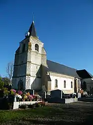 Saint-Martin Church. | |
.svg.png.webp) Coat of arms | |
Location of Forest-Montiers | |
 Forest-Montiers  Forest-Montiers | |
| Coordinates: 50°14′45″N 1°44′41″E | |
| Country | France |
| Region | Hauts-de-France |
| Department | Somme |
| Arrondissement | Abbeville |
| Canton | Abbeville-1 |
| Intercommunality | CC Ponthieu-Marquenterre |
| Government | |
| • Mayor (2020–2026) | Jean-Luc Martin[1] |
| Area 1 | 10.22 km2 (3.95 sq mi) |
| Population | 395 |
| • Density | 39/km2 (100/sq mi) |
| Time zone | UTC+01:00 (CET) |
| • Summer (DST) | UTC+02:00 (CEST) |
| INSEE/Postal code | 80332 /80120 |
| Elevation | 4–44 m (13–144 ft) (avg. 22 m or 72 ft) |
| 1 French Land Register data, which excludes lakes, ponds, glaciers > 1 km2 (0.386 sq mi or 247 acres) and river estuaries. | |
Geography
The commune is situated on the D32 road, near the N1/A16 autoroute junction, some 16 kilometres (10 mi) north of Abbeville.
Population
|
| ||||||||||||||||||||||||||||||||||||||||||
| Source: EHESS[3] and INSEE (1968-2017)[4] | |||||||||||||||||||||||||||||||||||||||||||
Places of interest
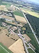 Aerial view.
 Saint-Riquier street.
 La forêt de Crécy.
.jpg.webp) WW1 monument.
WW1 monument._ND_des_4_chemins.JPG.webp) Notre-Dame des quatre chemins.
Notre-Dame des quatre chemins.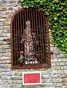 Saint Hubertus.
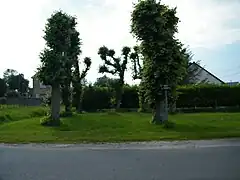 Cross in Neuville, rue de Ponthoile.
See also
References
- "Répertoire national des élus: les maires" (in French). data.gouv.fr, Plateforme ouverte des données publiques françaises. 13 September 2022.
- "Populations légales 2020". The National Institute of Statistics and Economic Studies. 29 December 2022.
- Des villages de Cassini aux communes d'aujourd'hui: Commune data sheet Forest-Montiers, EHESS (in French).
- Population en historique depuis 1968, INSEE
Wikimedia Commons has media related to Forest-Montiers.
This article is issued from Wikipedia. The text is licensed under Creative Commons - Attribution - Sharealike. Additional terms may apply for the media files.