Ville-le-Marclet
Ville-le-Marclet is a commune in the Somme department in Hauts-de-France in northern France.
Ville-le-Marclet | |
|---|---|
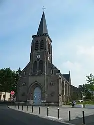 The church in Ville-le-Marclet | |
Location of Ville-le-Marclet | |
 Ville-le-Marclet  Ville-le-Marclet | |
| Coordinates: 50°01′24″N 2°05′22″E | |
| Country | France |
| Region | Hauts-de-France |
| Department | Somme |
| Arrondissement | Amiens |
| Canton | Flixecourt |
| Intercommunality | CC Nièvre et Somme |
| Government | |
| • Mayor (2020–2026) | Didier Leblanc[1] |
| Area 1 | 8.93 km2 (3.45 sq mi) |
| Population | 466 |
| • Density | 52/km2 (140/sq mi) |
| Time zone | UTC+01:00 (CET) |
| • Summer (DST) | UTC+02:00 (CEST) |
| INSEE/Postal code | 80795 /80420 |
| Elevation | 17–113 m (56–371 ft) (avg. 26 m or 85 ft) |
| 1 French Land Register data, which excludes lakes, ponds, glaciers > 1 km2 (0.386 sq mi or 247 acres) and river estuaries. | |
Geography
The commune is situated 24 km (15 miles) northwest of Amiens, on the D159 road and 1 mile(1.6 km) from a junction with the A16 autoroute.
Population
| Year | Pop. | ±% p.a. |
|---|---|---|
| 1968 | 485 | — |
| 1975 | 556 | +1.97% |
| 1982 | 512 | −1.17% |
| 1990 | 508 | −0.10% |
| 1999 | 511 | +0.07% |
| 2007 | 479 | −0.81% |
| 2012 | 500 | +0.86% |
| 2017 | 473 | −1.10% |
| Source: INSEE[3] | ||
See also
References
- "Répertoire national des élus: les maires" (in French). data.gouv.fr, Plateforme ouverte des données publiques françaises. 13 September 2022.
- "Populations légales 2020". The National Institute of Statistics and Economic Studies. 29 December 2022.
- Population en historique depuis 1968, INSEE
Wikimedia Commons has media related to Ville-le-Marclet.
This article is issued from Wikipedia. The text is licensed under Creative Commons - Attribution - Sharealike. Additional terms may apply for the media files.