Saint-Quentin-en-Tourmont
Saint-Quentin-en-Tourmont (French pronunciation: [sɛ̃ kɑ̃tɛ̃ ɑ̃ tuʁmɔ̃]; Picard: Saint-Quentin-in-Tourmont) is a commune in the Somme department in Hauts-de-France, on the French coast, in northern France.
Saint-Quentin-en-Tourmont | |
|---|---|
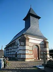 The church | |
Location of Saint-Quentin-en-Tourmont | |
 Saint-Quentin-en-Tourmont  Saint-Quentin-en-Tourmont | |
| Coordinates: 50°17′08″N 1°35′25″E | |
| Country | France |
| Region | Hauts-de-France |
| Department | Somme |
| Arrondissement | Abbeville |
| Canton | Rue |
| Intercommunality | CC Ponthieu-Marquenterre |
| Government | |
| • Mayor (2020–2026) | Francis Gouesbier[1] |
| Area 1 | 32.89 km2 (12.70 sq mi) |
| Population | 281 |
| • Density | 8.5/km2 (22/sq mi) |
| Time zone | UTC+01:00 (CET) |
| • Summer (DST) | UTC+02:00 (CEST) |
| INSEE/Postal code | 80713 /80120 |
| Elevation | 2–36 m (6.6–118.1 ft) (avg. 4 m or 13 ft) |
| 1 French Land Register data, which excludes lakes, ponds, glaciers > 1 km2 (0.386 sq mi or 247 acres) and river estuaries. | |
Geography
The communes is situated some 15 miles (24 km) northwest of Abbeville, on the D204 road, with part of the Marquenterre national park within the commune.
Population
| Year | Pop. | ±% p.a. |
|---|---|---|
| 1968 | 307 | — |
| 1975 | 261 | −2.29% |
| 1982 | 296 | +1.81% |
| 1990 | 309 | +0.54% |
| 1999 | 334 | +0.87% |
| 2007 | 309 | −0.97% |
| 2012 | 309 | +0.00% |
| 2017 | 282 | −1.81% |
| Source: INSEE[3] | ||
See also
References
- "Répertoire national des élus: les maires". data.gouv.fr, Plateforme ouverte des données publiques françaises (in French). 9 August 2021.
- "Populations légales 2020". The National Institute of Statistics and Economic Studies. 29 December 2022.
- Population en historique depuis 1968, INSEE
Wikimedia Commons has media related to Saint-Quentin-en-Tourmont.
This article is issued from Wikipedia. The text is licensed under Creative Commons - Attribution - Sharealike. Additional terms may apply for the media files.