Dargnies
Dargnies (French pronunciation: [daʁɲi]) is a commune in the Somme department in Hauts-de-France in northern France.
Dargnies | |
|---|---|
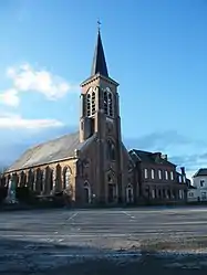 The church in Dargnies | |
Location of Dargnies | |
 Dargnies  Dargnies | |
| Coordinates: 50°02′33″N 1°31′34″E | |
| Country | France |
| Region | Hauts-de-France |
| Department | Somme |
| Arrondissement | Abbeville |
| Canton | Gamaches |
| Intercommunality | CC Villes Sœurs |
| Government | |
| • Mayor (2020–2026) | Benoît Ozenne[1] |
| Area 1 | 3.67 km2 (1.42 sq mi) |
| Population | 1,184 |
| • Density | 320/km2 (840/sq mi) |
| Time zone | UTC+01:00 (CET) |
| • Summer (DST) | UTC+02:00 (CEST) |
| INSEE/Postal code | 80235 /80570 |
| Elevation | 81–129 m (266–423 ft) (avg. 118 m or 387 ft) |
| 1 French Land Register data, which excludes lakes, ponds, glaciers > 1 km2 (0.386 sq mi or 247 acres) and river estuaries. | |
Geography
Dargnies is situated on the D2 and D19 road junction, high up in the valley of the Bresle, some 15 miles (24 km) southwest of Abbeville.
Population
| Year | Pop. | ±% p.a. |
|---|---|---|
| 1968 | 1,347 | — |
| 1975 | 1,455 | +1.11% |
| 1982 | 1,388 | −0.67% |
| 1990 | 1,481 | +0.81% |
| 1999 | 1,443 | −0.29% |
| 2007 | 1,336 | −0.96% |
| 2012 | 1,311 | −0.38% |
| 2017 | 1,246 | −1.01% |
| Source: INSEE[3] | ||
See also
References
- "Répertoire national des élus: les maires". data.gouv.fr, Plateforme ouverte des données publiques françaises (in French). 2 December 2020.
- "Populations légales 2020". The National Institute of Statistics and Economic Studies. 29 December 2022.
- Population en historique depuis 1968, INSEE
Wikimedia Commons has media related to Dargnies.
This article is issued from Wikipedia. The text is licensed under Creative Commons - Attribution - Sharealike. Additional terms may apply for the media files.