Guyencourt-Saulcourt
Guyencourt-Saulcourt is a commune in the Somme department in Hauts-de-France in northern France.
Guyencourt-Saulcourt | |
|---|---|
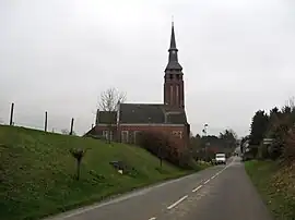 The church in Guyencourt-Saulcourt | |
Location of Guyencourt-Saulcourt | |
 Guyencourt-Saulcourt  Guyencourt-Saulcourt | |
| Coordinates: 50°00′01″N 3°04′51″E | |
| Country | France |
| Region | Hauts-de-France |
| Department | Somme |
| Arrondissement | Péronne |
| Canton | Péronne |
| Intercommunality | Haute Somme |
| Government | |
| • Mayor (2020–2026) | Jean-Marie Blondelle[1] |
| Area 1 | 5 km2 (2 sq mi) |
| Population | 142 |
| • Density | 28/km2 (74/sq mi) |
| Time zone | UTC+01:00 (CET) |
| • Summer (DST) | UTC+02:00 (CEST) |
| INSEE/Postal code | 80404 /80240 |
| Elevation | 110–147 m (361–482 ft) (avg. 150 m or 490 ft) |
| 1 French Land Register data, which excludes lakes, ponds, glaciers > 1 km2 (0.386 sq mi or 247 acres) and river estuaries. | |
Geography
The commune is situated on the D181 road, some 18 miles (29 km) northwest of Saint-Quentin.
Population
| Year | Pop. | ±% p.a. |
|---|---|---|
| 1968 | 207 | — |
| 1975 | 169 | −2.86% |
| 1982 | 139 | −2.75% |
| 1990 | 137 | −0.18% |
| 1999 | 148 | +0.86% |
| 2007 | 134 | −1.23% |
| 2012 | 145 | +1.59% |
| 2017 | 140 | −0.70% |
| Source: INSEE[3] | ||
References
- "Répertoire national des élus: les maires". data.gouv.fr, Plateforme ouverte des données publiques françaises (in French). 2 December 2020.
- "Populations légales 2020". The National Institute of Statistics and Economic Studies. 29 December 2022.
- Population en historique depuis 1968, INSEE
Wikimedia Commons has media related to Guyencourt-Saulcourt.
This article is issued from Wikipedia. The text is licensed under Creative Commons - Attribution - Sharealike. Additional terms may apply for the media files.