Lignières-Châtelain
Lignières-Châtelain (French: [liɲjɛʁ ʃɑtlɛ̃]; Picard: Lignère-Catelain) is a commune in the Somme department in Hauts-de-France in northern France.
Lignières-Châtelain
| |
|---|---|
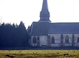 The church in Lignières-Châtelain | |
 Coat of arms | |
Location of Lignières-Châtelain | |
 Lignières-Châtelain  Lignières-Châtelain | |
| Coordinates: 49°46′32″N 1°51′49″E | |
| Country | France |
| Region | Hauts-de-France |
| Department | Somme |
| Arrondissement | Amiens |
| Canton | Poix-de-Picardie |
| Intercommunality | Somme Sud-Ouest |
| Government | |
| • Mayor (2020–2026) | Hubert Avet[1] |
| Area 1 | 6.54 km2 (2.53 sq mi) |
| Population | 343 |
| • Density | 52/km2 (140/sq mi) |
| Demonym(s) | Ligniérois, Ligniéroises |
| Time zone | UTC+01:00 (CET) |
| • Summer (DST) | UTC+02:00 (CEST) |
| INSEE/Postal code | 80479 /80290 |
| Elevation | 186–209 m (610–686 ft) (avg. 195 m or 640 ft) |
| 1 French Land Register data, which excludes lakes, ponds, glaciers > 1 km2 (0.386 sq mi or 247 acres) and river estuaries. | |
Geography
The commune is situated on the N29 road, some 23 miles (37 km) southwest of Amiens.
Population
| Year | Pop. | ±% p.a. |
|---|---|---|
| 1968 | 315 | — |
| 1975 | 295 | −0.93% |
| 1982 | 270 | −1.26% |
| 1990 | 272 | +0.09% |
| 1999 | 284 | +0.48% |
| 2007 | 360 | +3.01% |
| 2012 | 341 | −1.08% |
| 2017 | 385 | +2.46% |
| Source: INSEE[3] | ||
Places of interest
- Church of Saint-Barthélémy
_1.jpg.webp)
Sundial on the church
See also
References
- "Répertoire national des élus: les maires" (in French). data.gouv.fr, Plateforme ouverte des données publiques françaises. 13 September 2022.
- "Populations légales 2020". The National Institute of Statistics and Economic Studies. 29 December 2022.
- Population en historique depuis 1968, INSEE
This article is issued from Wikipedia. The text is licensed under Creative Commons - Attribution - Sharealike. Additional terms may apply for the media files.