Hénencourt
Hénencourt (French pronunciation: [enɑ̃kuʁ]; Picard: Hinincourt) is a commune in the Somme department in Hauts-de-France in northern France.
Hénencourt | |
|---|---|
 | |
 Coat of arms | |
Location of Hénencourt | |
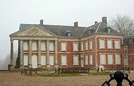
 Hénencourt  Hénencourt | |
| Coordinates: 50°00′10″N 2°33′50″E | |
| Country | France |
| Region | Hauts-de-France |
| Department | Somme |
| Arrondissement | Amiens |
| Canton | Corbie |
| Intercommunality | Val de Somme |
| Government | |
| • Mayor (2020–2026) | Gilles Roussel[1] |
| Area 1 | 3.26 km2 (1.26 sq mi) |
| Population | 193 |
| • Density | 59/km2 (150/sq mi) |
| Time zone | UTC+01:00 (CET) |
| • Summer (DST) | UTC+02:00 (CEST) |
| INSEE/Postal code | 80429 /80300 |
| Elevation | 83–121 m (272–397 ft) (avg. 90 m or 300 ft) |
| 1 French Land Register data, which excludes lakes, ponds, glaciers > 1 km2 (0.386 sq mi or 247 acres) and river estuaries. | |
Geography
The commune is situated at the junction of the D91 and the D119 roads, some 15 miles (24 km) northeast of Amiens.
Population
| Year | Pop. | ±% p.a. |
|---|---|---|
| 1968 | 174 | — |
| 1975 | 176 | +0.16% |
| 1982 | 165 | −0.92% |
| 1990 | 205 | +2.75% |
| 1999 | 193 | −0.67% |
| 2007 | 177 | −1.08% |
| 2012 | 192 | +1.64% |
| 2017 | 195 | +0.31% |
| Source: INSEE[3] | ||
See also
References
- "Répertoire national des élus: les maires". data.gouv.fr, Plateforme ouverte des données publiques françaises (in French). 2 December 2020.
- "Populations légales 2020". The National Institute of Statistics and Economic Studies. 29 December 2022.
- Population en historique depuis 1968, INSEE
Wikimedia Commons has media related to Hénencourt.
This article is issued from Wikipedia. The text is licensed under Creative Commons - Attribution - Sharealike. Additional terms may apply for the media files.