Strazeele
Strazeele (French pronunciation: [stʁazɛl]; from Flemish; Strazele in modern Dutch spelling) is a commune in the Nord department in northern France.[3]
Strazeele
Strazele | |
|---|---|
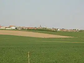 A general view of Strazeele | |
_Nord-france.svg.png.webp) Coat of arms | |
Location of Strazeele | |
 Strazeele  Strazeele | |
| Coordinates: 50°43′39″N 2°37′55″E | |
| Country | France |
| Region | Hauts-de-France |
| Department | Nord |
| Arrondissement | Dunkerque |
| Canton | Bailleul |
| Intercommunality | Flandre Intérieure |
| Government | |
| • Mayor (2020–2026) | Élisabeth Gressier[1] |
| Area 1 | 4.69 km2 (1.81 sq mi) |
| Population | 947 |
| • Density | 200/km2 (520/sq mi) |
| Demonym | Strazeelois(es) |
| Time zone | UTC+01:00 (CET) |
| • Summer (DST) | UTC+02:00 (CEST) |
| INSEE/Postal code | 59582 /59270 |
| Elevation | 17–61 m (56–200 ft) (avg. 51 m or 167 ft) |
| 1 French Land Register data, which excludes lakes, ponds, glaciers > 1 km2 (0.386 sq mi or 247 acres) and river estuaries. | |
Heraldry
.svg.png.webp) Arms of Strazeele |
The arms of Strazeele are blazoned : Gules, a bend, between in orle 6 mullets of six points Or.
|
See also
References
- "Répertoire national des élus: les maires". data.gouv.fr, Plateforme ouverte des données publiques françaises (in French). 2 December 2020.
- "Populations légales 2020". The National Institute of Statistics and Economic Studies. 29 December 2022.
- INSEE commune file
Wikimedia Commons has media related to Strazeele.
This article is issued from Wikipedia. The text is licensed under Creative Commons - Attribution - Sharealike. Additional terms may apply for the media files.