Merris
Merris (French pronunciation: [mɛʁis]) is a commune in the Nord department in northern France.[3]
Merris | |
|---|---|
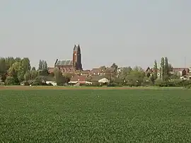 A general view of Merris | |
_Nord-France.svg.png.webp) Coat of arms | |
Location of Merris | |
 Merris  Merris | |
| Coordinates: 50°42′59″N 2°39′40″E | |
| Country | France |
| Region | Hauts-de-France |
| Department | Nord |
| Arrondissement | Dunkerque |
| Canton | Bailleul |
| Intercommunality | Flandre Intérieure |
| Government | |
| • Mayor (2020–2026) | Yves Delfolie[1] |
| Area 1 | 10.09 km2 (3.90 sq mi) |
| Population | 1,009 |
| • Density | 100/km2 (260/sq mi) |
| Demonym | Merrisiens(iennes) |
| Time zone | UTC+01:00 (CET) |
| • Summer (DST) | UTC+02:00 (CEST) |
| INSEE/Postal code | 59399 /59270 |
| Elevation | 18–61 m (59–200 ft) (avg. 23 m or 75 ft) |
| 1 French Land Register data, which excludes lakes, ponds, glaciers > 1 km2 (0.386 sq mi or 247 acres) and river estuaries. | |
It is about 15 km (9.3 mi) west-northwest of Armentières, and about 20 km (12 mi) north of Béthune.
Heraldry
Arms of Merris |
The arms of Merris are blazoned : Argent, 3 horns sable tied gules. (Hardifort, Merris and Oudezeele use the same arms.)
|
See also
References
- "Répertoire national des élus: les maires". data.gouv.fr, Plateforme ouverte des données publiques françaises (in French). 2 December 2020.
- "Populations légales 2020". The National Institute of Statistics and Economic Studies. 29 December 2022.
- INSEE commune file
Wikimedia Commons has media related to Merris.
This article is issued from Wikipedia. The text is licensed under Creative Commons - Attribution - Sharealike. Additional terms may apply for the media files.