Saint-Pierre-Brouck
Saint-Pierre-Brouck (French pronunciation: [sɛ̃ pjɛʁ bʁuk]; from Dutch Sint-Pietersbroek, meaning "Saint-Peter marsh"; West Flemish: Sint-Pieters-Broek) ) is a commune in the Nord department in northern France.[3]
Saint-Pierre-Brouck
Sint-Pietersbroek | |
|---|---|
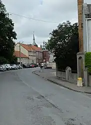 A view within Saint-Pierre-Brouck | |
.svg.png.webp) Coat of arms | |
Location of Saint-Pierre-Brouck | |
 Saint-Pierre-Brouck  Saint-Pierre-Brouck | |
| Coordinates: 50°53′47″N 2°11′14″E | |
| Country | France |
| Region | Hauts-de-France |
| Department | Nord |
| Arrondissement | Dunkerque |
| Canton | Grande-Synthe |
| Intercommunality | Hauts de Flandre |
| Government | |
| • Mayor (2020–2026) | Gérard Grondel[1] |
| Area 1 | 8.86 km2 (3.42 sq mi) |
| Population | 984 |
| • Density | 110/km2 (290/sq mi) |
| Time zone | UTC+01:00 (CET) |
| • Summer (DST) | UTC+02:00 (CEST) |
| INSEE/Postal code | 59539 /59630 |
| Elevation | 1–5 m (3.3–16.4 ft) (avg. 3 m or 9.8 ft) |
| 1 French Land Register data, which excludes lakes, ponds, glaciers > 1 km2 (0.386 sq mi or 247 acres) and river estuaries. | |
Heraldry
Arms of Saint-Pierre-Brouck |
The arms of Saint-Pierre-Brouck are blazoned : Sable, 4 keys argent. (Leers and Saint-Pierre-Brouck use the same arms.)
|
See also
References
- "Répertoire national des élus: les maires". data.gouv.fr, Plateforme ouverte des données publiques françaises (in French). 2 December 2020.
- "Populations légales 2020". The National Institute of Statistics and Economic Studies. 29 December 2022.
- INSEE commune file
Wikimedia Commons has media related to Saint-Pierre-Brouck.
This article is issued from Wikipedia. The text is licensed under Creative Commons - Attribution - Sharealike. Additional terms may apply for the media files.