Mérignies
Mérignies (French pronunciation: [meʁiɲi]) is a commune in the Nord department of the Hauts-de-France region of northern France.[3] The village is situated around 19 kilometres outside of the city of Lille and in 2019 had a recorded population of 3,199.[4]
Mérignies | |
|---|---|
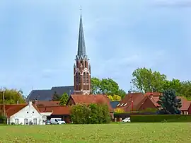 The church in Mérignies | |
_Nord-France.svg.png.webp) Coat of arms | |
Location of Mérignies | |
 Mérignies  Mérignies | |
| Coordinates: 50°30′23″N 3°06′39″E | |
| Country | France |
| Region | Hauts-de-France |
| Department | Nord |
| Arrondissement | Lille |
| Canton | Templeuve-en-Pévèle |
| Intercommunality | CC Pévèle-Carembault |
| Government | |
| • Mayor (2020–2026) | Paul Dhallewyn[1] |
| Area 1 | 8.61 km2 (3.32 sq mi) |
| Population | 3,289 |
| • Density | 380/km2 (990/sq mi) |
| Time zone | UTC+01:00 (CET) |
| • Summer (DST) | UTC+02:00 (CEST) |
| INSEE/Postal code | 59398 /59710 |
| Elevation | 32–56 m (105–184 ft) (avg. 39 m or 128 ft) |
| 1 French Land Register data, which excludes lakes, ponds, glaciers > 1 km2 (0.386 sq mi or 247 acres) and river estuaries. | |
Heraldry
Arms of Mérignies |
The arms of Mérignies are blazoned : Plumetty Or and sable. (Mérignies and Vendeville use the same arms.)
|
Twinning
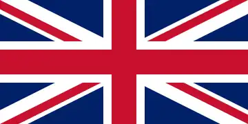 Kilmacolm, Scotland, United Kingdom (Since 2014, concluding with visits by delegations from both settlements)
See also
References
- "Répertoire national des élus: les maires" (in French). data.gouv.fr, Plateforme ouverte des données publiques françaises. 13 September 2022.
- "Populations légales 2020". The National Institute of Statistics and Economic Studies. 29 December 2022.
- INSEE commune file
- Populations légales 2019: 59 Nord, INSEE
Wikimedia Commons has media related to Mérignies.
This article is issued from Wikipedia. The text is licensed under Creative Commons - Attribution - Sharealike. Additional terms may apply for the media files.