Floursies
Floursies (French pronunciation: [fluʁsi]) is a commune in the Nord department in northern France.[3]
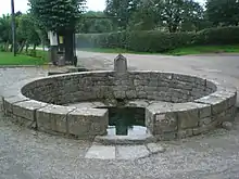
St. Eloi Fountain
Floursies | |
|---|---|
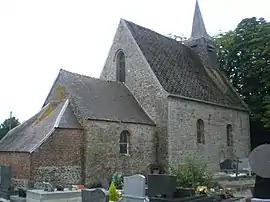 The church in Floursies | |
.svg.png.webp) Coat of arms | |
Location of Floursies | |
 Floursies  Floursies | |
| Coordinates: 50°10′56″N 3°58′10″E | |
| Country | France |
| Region | Hauts-de-France |
| Department | Nord |
| Arrondissement | Avesnes-sur-Helpe |
| Canton | Avesnes-sur-Helpe |
| Intercommunality | Cœur de l'Avesnois |
| Government | |
| • Mayor (2020–2026) | Alain Deltour[1] |
| Area 1 | 4.65 km2 (1.80 sq mi) |
| Population | 127 |
| • Density | 27/km2 (71/sq mi) |
| Time zone | UTC+01:00 (CET) |
| • Summer (DST) | UTC+02:00 (CEST) |
| INSEE/Postal code | 59240 /59440 |
| Elevation | 177–208 m (581–682 ft) (avg. 120 m or 390 ft) |
| 1 French Land Register data, which excludes lakes, ponds, glaciers > 1 km2 (0.386 sq mi or 247 acres) and river estuaries. | |
Heraldry
Arms of Floursies |
The arms of Floursies are blazoned : Azure, 3 keys Or. (Floursies, Hargnies and Raismes use the same arms.)
|
See also
References
- "Répertoire national des élus: les maires". data.gouv.fr, Plateforme ouverte des données publiques françaises (in French). 2 December 2020.
- "Populations légales 2020". The National Institute of Statistics and Economic Studies. 29 December 2022.
- INSEE commune file
Wikimedia Commons has media related to Floursies.
This article is issued from Wikipedia. The text is licensed under Creative Commons - Attribution - Sharealike. Additional terms may apply for the media files.