Saint-Marcel-lès-Sauzet
Saint-Marcel-lès-Sauzet (French pronunciation: [sɛ̃ maʁsɛl lɛ sozɛ], literally Saint-Marcel near Sauzet; Occitan: Sant Marcèu de Sauset) is a commune in the Drôme department in southeastern France.
Saint-Marcel-lès-Sauzet | |
|---|---|
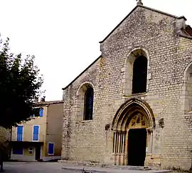 The church of Saint-Marcel-lès-Sauzet | |
Location of Saint-Marcel-lès-Sauzet | |
 Saint-Marcel-lès-Sauzet  Saint-Marcel-lès-Sauzet | |
| Coordinates: 44°35′46″N 4°48′18″E | |
| Country | France |
| Region | Auvergne-Rhône-Alpes |
| Department | Drôme |
| Arrondissement | Nyons |
| Canton | Dieulefit |
| Intercommunality | Montélimar Agglomération |
| Government | |
| • Mayor (2020–2026) | Yves Lévêque[1] |
| Area 1 | 3.98 km2 (1.54 sq mi) |
| Population | 1,269 |
| • Density | 320/km2 (830/sq mi) |
| Time zone | UTC+01:00 (CET) |
| • Summer (DST) | UTC+02:00 (CEST) |
| INSEE/Postal code | 26312 /26740 |
| Elevation | 104–290 m (341–951 ft) |
| 1 French Land Register data, which excludes lakes, ponds, glaciers > 1 km2 (0.386 sq mi or 247 acres) and river estuaries. | |
Population
| Year | Pop. | ±% |
|---|---|---|
| 1911 | 278 | — |
| 1962 | 271 | −2.5% |
| 1968 | 358 | +32.1% |
| 1975 | 405 | +13.1% |
| 1982 | 620 | +53.1% |
| 1990 | 1,025 | +65.3% |
| 1999 | 1,104 | +7.7% |
| 2008 | 1,138 | +3.1% |
See also
References
- "Répertoire national des élus: les maires" (in French). data.gouv.fr, Plateforme ouverte des données publiques françaises. 13 September 2022.
- "Populations légales 2020". The National Institute of Statistics and Economic Studies. 29 December 2022.
Wikimedia Commons has media related to Saint-Marcel-lès-Sauzet.
This article is issued from Wikipedia. The text is licensed under Creative Commons - Attribution - Sharealike. Additional terms may apply for the media files.