Saint-André-le-Gaz
Saint-André-le-Gaz (French pronunciation: [sɛ̃.t‿ɑ̃dʁe lə ɡaz]) is a commune in the Isère department in southeastern France.[3]
Saint-André-le-Gaz | |
|---|---|
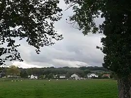 A general view of Saint-André-le-Gaz | |
Location of Saint-André-le-Gaz | |
 Saint-André-le-Gaz  Saint-André-le-Gaz | |
| Coordinates: 45°32′59″N 5°32′06″E | |
| Country | France |
| Region | Auvergne-Rhône-Alpes |
| Department | Isère |
| Arrondissement | La Tour-du-Pin |
| Canton | La Tour-du-Pin |
| Government | |
| • Mayor (2020–2026) | Magali Guillot[1] |
| Area 1 | 8.89 km2 (3.43 sq mi) |
| Population | 2,761 |
| • Density | 310/km2 (800/sq mi) |
| Time zone | UTC+01:00 (CET) |
| • Summer (DST) | UTC+02:00 (CEST) |
| INSEE/Postal code | 38357 /38490 |
| Elevation | 356–488 m (1,168–1,601 ft) (avg. 409 m or 1,342 ft) |
| 1 French Land Register data, which excludes lakes, ponds, glaciers > 1 km2 (0.386 sq mi or 247 acres) and river estuaries. | |
Geography
The Bourbre forms the commune's eastern border. Saint-André-le-Gaz station has rail connections to Lyon, Grenoble and Chambéry.
Population
|
|
See also
References
- "Répertoire national des élus: les maires". data.gouv.fr, Plateforme ouverte des données publiques françaises (in French). 2 December 2020.
- "Populations légales 2020". The National Institute of Statistics and Economic Studies. 29 December 2022.
- INSEE commune file
External links
Wikimedia Commons has media related to Saint-André-le-Gaz.
This article is issued from Wikipedia. The text is licensed under Creative Commons - Attribution - Sharealike. Additional terms may apply for the media files.