Revel-Tourdan
Revel-Tourdan (French pronunciation: [ʁəvɛl tuʁdɑ̃]) is a commune in the Isère department in southeastern France.[3] A Gallo-Roman silver situla from Tourdan is now in the British Museum's Collection.[4]
Revel-Tourdan | |
|---|---|
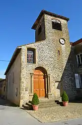 The church of Revel | |
Location of Revel-Tourdan | |
 Revel-Tourdan  Revel-Tourdan | |
| Coordinates: 45°23′05″N 5°02′21″E | |
| Country | France |
| Region | Auvergne-Rhône-Alpes |
| Department | Isère |
| Arrondissement | Vienne |
| Canton | Roussillon |
| Intercommunality | Entre Bièvre et Rhône |
| Government | |
| • Mayor (2020–2026) | Yvan Argoud[1] |
| Area 1 | 11.62 km2 (4.49 sq mi) |
| Population | 1,050 |
| • Density | 90/km2 (230/sq mi) |
| Time zone | UTC+01:00 (CET) |
| • Summer (DST) | UTC+02:00 (CEST) |
| INSEE/Postal code | 38335 /38270 |
| Elevation | 267–444 m (876–1,457 ft) (avg. 480 m or 1,570 ft) |
| 1 French Land Register data, which excludes lakes, ponds, glaciers > 1 km2 (0.386 sq mi or 247 acres) and river estuaries. | |
Population
| Year | Pop. | ±% p.a. |
|---|---|---|
| 1968 | 531 | — |
| 1975 | 549 | +0.48% |
| 1982 | 630 | +1.99% |
| 1990 | 794 | +2.93% |
| 1999 | 842 | +0.65% |
| 2007 | 963 | +1.69% |
| 2012 | 1,030 | +1.35% |
| 2017 | 1,053 | +0.44% |
| Source: INSEE[5] | ||
See also
References
- "Répertoire national des élus: les maires". data.gouv.fr, Plateforme ouverte des données publiques françaises (in French). 9 August 2021.
- "Populations légales 2020". The National Institute of Statistics and Economic Studies. 29 December 2022.
- INSEE commune file
- British Museum Collection
- Population en historique depuis 1968, INSEE
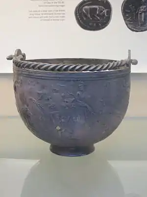
The Tourdan Situla in the British Museum
Wikimedia Commons has media related to Revel-Tourdan.
This article is issued from Wikipedia. The text is licensed under Creative Commons - Attribution - Sharealike. Additional terms may apply for the media files.