Sérézin-de-la-Tour
Sérézin-de-la-Tour (French pronunciation: [seʁezɛ̃ də la tuʁ], literally Sérézin of La Tour) is a commune in the Isère department in the region Auvergne-Rhône-Alpes southeastern France.[3]
Sérézin-de-la-Tour | |
|---|---|
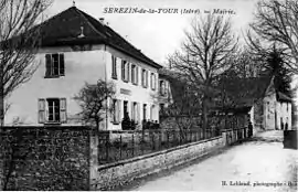 Sérezin-la Tour town hall in 1908 | |
Location of Sérézin-de-la-Tour | |
 Sérézin-de-la-Tour  Sérézin-de-la-Tour | |
| Coordinates: 45°33′30″N 5°20′42″E | |
| Country | France |
| Region | Auvergne-Rhône-Alpes |
| Department | Isère |
| Arrondissement | La Tour-du-Pin |
| Canton | Bourgoin-Jallieu |
| Intercommunality | CA Porte de l'Isère |
| Government | |
| • Mayor (2020–2026) | Daniel Wajda[1] |
| Area 1 | 9.31 km2 (3.59 sq mi) |
| Population | 1,130 |
| • Density | 120/km2 (310/sq mi) |
| Demonym | Sérézinnois |
| Time zone | UTC+01:00 (CET) |
| • Summer (DST) | UTC+02:00 (CEST) |
| INSEE/Postal code | 38481 /38300 |
| Elevation | 266–466 m (873–1,529 ft) (avg. 318 m or 1,043 ft) |
| Website | https://www.serezindelatour.fr/ |
| 1 French Land Register data, which excludes lakes, ponds, glaciers > 1 km2 (0.386 sq mi or 247 acres) and river estuaries. | |
Its inhabitants are known as the Sérézinnois.
Geography
The Bourbre forms part of the commune's northern border.
Population
|
|
See also
References
- "Répertoire national des élus: les maires" (in French). data.gouv.fr, Plateforme ouverte des données publiques françaises. 13 September 2022.
- "Populations légales 2020". The National Institute of Statistics and Economic Studies. 29 December 2022.
- INSEE commune file
Wikimedia Commons has media related to Sérézin-de-la-Tour.
This article is issued from Wikipedia. The text is licensed under Creative Commons - Attribution - Sharealike. Additional terms may apply for the media files.