Urangeline East, New South Wales
Urangeline East is a rural community in the central part of the Riverina. It is situated by road, about 9 kilometres southeast from Urangeline and 19 kilometres east from Bidgeemia.
| Urangeline East New South Wales | |
|---|---|
 Sign | |
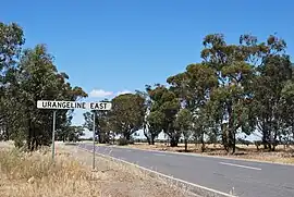
 Urangeline East | |
| Coordinates | 35°28′58″S 146°41′39″E |
| Population | 37 (SAL 2021)[1] |
| Postcode(s) | 2656 |
| Elevation | 151 m (495 ft) |
| Location |
|
| County | Urana |
| State electorate(s) | Wagga Wagga |
Bendabo Post Office opened on 1 November 1928, was renamed Urangeline East in 1930 and closed in 1971.[2]
It was serviced by the Rand branch railway line before the line was closed in 1975.
Notes and references
- Australian Bureau of Statistics (28 June 2022). "Urangeline East (Suburb and Locality)". Australian Census 2021 QuickStats. Retrieved 28 June 2022.
- Premier Postal History, Post Office List, retrieved 11 June 2009
External links
Wikimedia Commons has media related to Urangeline East, New South Wales.
This article is issued from Wikipedia. The text is licensed under Creative Commons - Attribution - Sharealike. Additional terms may apply for the media files.