Pulletop, New South Wales
Pulletop is a rural locality in the south eastern part of the Riverina - it used to be called Pullitop. It is situated by road, about 5 kilometres east south-east of Burrandana[2] and 9 kilometres north of Westby.
| Pulletop New South Wales | |
|---|---|
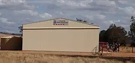 Pulletop Fire Brigade Shed | |
 Pulletop Location in New South Wales | |
| Coordinates | 35°27′03″S 147°23′24″E |
| Population | 64 (SAL 2021)[1] |
| Postcode(s) | 2650 |
| Location |
|
| LGA(s) | City of Wagga Wagga |
| County | Mitchell |
| State electorate(s) | Wagga Wagga |
See also
Notes and references
- Australian Bureau of Statistics (28 June 2022). "Pulletop (Suburb and Locality)". Australian Census 2021 QuickStats. Retrieved 28 June 2022.
- "Pulletop". Geographical Names Register (GNR) of NSW. Geographical Names Board of New South Wales.
Wikimedia Commons has media related to Pulletop, New South Wales.
This article is issued from Wikipedia. The text is licensed under Creative Commons - Attribution - Sharealike. Additional terms may apply for the media files.