Moira, New South Wales
Moira is a rural community in the central south part of the Riverina and the site of a railway station. It is situated by road, about 11 kilometres north of Barnes and 15 kilometres south west of Mathoura.
| Moira New South Wales | |
|---|---|
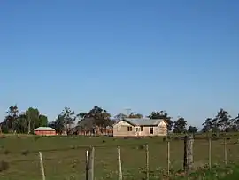 Moira homestead | |
 Moira | |
| Coordinates | 35°55′37″S 144°50′52″E |
| Postcode(s) | 2710 |
| Elevation | 99 m (325 ft) |
| Location | |
| LGA(s) | Murray River Council |
| County | Cowper |
| State electorate(s) | Murray |
| Federal division(s) | Farrer |
Moira Post Office opened on 16 December 1879 and closed in 1970.[1]
Notes
- Premier Postal History, Post Office List, retrieved 11 June 2009
External links
Wikimedia Commons has media related to Moira, New South Wales.
This article is issued from Wikipedia. The text is licensed under Creative Commons - Attribution - Sharealike. Additional terms may apply for the media files.