Muttama, New South Wales
Muttama is a rural community in the central east part of the Riverina. It is situated by road, about 24 kilometres south of Cootamundra and 17 kilometres north of Coolac.
| Muttama New South Wales | |||||||||||||||
|---|---|---|---|---|---|---|---|---|---|---|---|---|---|---|---|
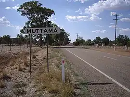 Entering Muttama | |||||||||||||||
 Muttama | |||||||||||||||
| Coordinates | 34°48′10″S 148°07′01″E | ||||||||||||||
| Population | 140 (SAL 2021)[1] | ||||||||||||||
| Postcode(s) | 2722 | ||||||||||||||
| Elevation | 357 m (1,171 ft) | ||||||||||||||
| Location |
| ||||||||||||||
| LGA(s) | Cootamundra-Gundagai Regional Council | ||||||||||||||
| County | Harden | ||||||||||||||
| State electorate(s) | Cootamundra | ||||||||||||||
| Federal division(s) | |||||||||||||||
| |||||||||||||||
The name Muttama is derived from the local Aboriginal word meaning "like it" or "take it".[2]
Mining in the area began in the 1860s and Muttama prospered with the discovery of gold at Muttama Reef in 1882.[3] Muttama Reef Post Office opened on 1 February 1876, was renamed Muttama in 1889, and closed on 12 October 1979.[4] The village was served by a railway station on the Tumut branch from 1886 to 1975, when passenger services were discontinued. All goods traffic on line was suspended after flooding in 1984.[5]
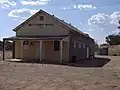 Muttama Hall
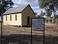 Muttama Uniting Church
References
- Australian Bureau of Statistics (28 June 2022). "Muttama (Suburb and Locality)". Australian Census 2021 QuickStats. Retrieved 28 June 2022.
- "Muttama". Geographical Names Register (GNR) of NSW. Geographical Names Board of New South Wales.
- "THE MUTTAMA REEF GOLD RUSH". The Australasian. Vol. XXII, no. 823. Victoria, Australia. 7 January 1882. p. 21 – via National Library of Australia.
- Premier Postal History, Post Office List, retrieved 21 February 2011
- "Tumut Branch". nswrail.net. Retrieved 5 August 2014.
External links
![]() Media related to Muttama, New South Wales at Wikimedia Commons
Media related to Muttama, New South Wales at Wikimedia Commons