Brisbane Valley Highway
The Brisbane Valley Highway is a state highway in Queensland, Australia. It links the Warrego Highway near Ipswich and the D'Aguilar Highway about 4 km (2 mi) north of Harlin. Its direction follows the approximate course of the Brisbane River.[1] It is part of State Route A17, which is duplexed with the D'Aguilar Highway to Nanango and then becomes the Burnett Highway. State Route 85 is duplexed with the Brisbane Valley Highway from Esk to the D'Aguilar Highway.
Brisbane Valley Highway | |
|---|---|
 | |
| Brisbane Valley Highway (green and black) | |
| General information | |
| Type | Highway |
| Length | 89.5 km (56 mi) |
| Route number(s) |
|
| Former route number | |
| Major junctions | |
| South end | |
| North end | |
| Location(s) | |
| Major settlements | Fernvale, Esk, Toogoolawah, Harlin |
| Highway system | |
The highway crosses the Wivenhoe Dam about 9 km (6 mi) north-west of Fernvale.
Upgrades
Intersection with Warrego Highway
From 2015, the intersection with the Warrego Highway was converted into a grade-separated interchange.[2]
Pedestrian facilities
A project to upgrade pedestrian facilities in Fernvale, at a cost of $1.566 million, was due for completion in early 2022.[3]
Safety improvements
A project to improve safety on a section of the highway, at a cost of $14.4 million, was due for completion in mid-2022.[4]
Pavement rehabilitation
A project to rehabilitate the road surface through Esk township, at a cost of $5.5 million, was due for completion in mid-2022.[5]
List of towns along the Brisbane Valley Highway
Major intersections
| LGA | Location | km | mi | Destinations | Notes |
|---|---|---|---|---|---|
| Ipswich | Blacksoil | 0 | 0.0 | Southern end of Brisbane Valley Highway | |
| Somerset | Fernvale | 16.2 | 10.1 | Forest Hill–Fernvale Road – south–west – Lowood | |
| Brisbane River | 18.3 | 11.4 | Geoff Fisher Bridge. This bridge spans the boundary between the localities of Fernvale and Wivenhoe Pocket | ||
| Somerset | Wivenhoe Pocket | 20.1 | 12.5 | Wivenhoe–Somerset Road – north–east – Mount Glorious, Somerset Dam (via Splityard Creek Dam) | To Brisbane Forest Park via Northbrook Parkway |
| Brisbane River | 22.5– 25.0 | 14.0– 15.5 | Wivenhoe Dam wall. The dam wall is in the locality of Lake Wivenhoe.[6][7] | ||
| Somerset | Coominya | 32.6 | 20.3 | Coominya Connection Road – south – Coominya, Atkinson Dam | |
| Esk | 53.8 | 33.4 | Gatton–Esk Road – south – Gatton, Toowoomba | ||
| 54.2 | 33.7 | State Route 85 southern concurrency terminus: continues south–west as Esk–Hampton Road. | |||
| 58.1 | 36.1 | Esk-Kilcoy Road – east – Kilcoy (via Somerset Dam) | |||
| Harlin | 89.5 | 55.6 | State Route 85 northern concurrency terminus: continues east as D'Aguilar Highway. North–west to Moore and Yarraman; east to Kilcoy and Sunshine Coast. | ||
| |||||
Gallery
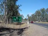 Brisbane Valley Highway at Wanora, 2014
See also
References
- "Brisbane Valley Highway, Metropolitan Queensland". Queensland Online. Roam Media (for RACQ and Department of Transport and Main Roads). Archived from the original on 2 November 2013. Retrieved 31 October 2013.
- "Warrego Highway and Brisbane Valley Highway". Department of Transport and Main Roads - Projects. Queensland Government. 7 October 2013. Archived from the original on 1 November 2013. Retrieved 31 October 2013.
- "Brisbane Valley Highway (Ipswich-Harlin), Fernvale, upgrade pedestrian facilities". Queensland Government. 11 January 2022. Archived from the original on 22 May 2022. Retrieved 22 May 2022.
- "Brisbane Valley Highway (Ipswich-Harlin), Warrego Highway to Fernvale, improve safety". Queensland Government. 4 March 2022. Archived from the original on 6 June 2021. Retrieved 22 May 2022.
- "Brisbane Valley Highway (Ipswich-Harlin) Esk rehabilitate pavement". Queensland Government. 22 November 2021. Archived from the original on 22 May 2022. Retrieved 22 May 2022.
- Google (4 November 2013). "Locality of Lake Wivenhoe, Queensland" (Map). Google Maps. Google. Retrieved 4 November 2013.
- "Lake Wivenhoe (entry 44880)". Queensland Place Names. Queensland Government. Retrieved 4 November 2013.
External links
![]() Media related to Brisbane Valley Highway at Wikimedia Commons
Media related to Brisbane Valley Highway at Wikimedia Commons