Ridgewood, Ohio
Ridgewood is a census-designated place (CDP) in Hamilton County, Ohio, United States, adjacent to the city of Cincinnati. It was first listed as a CDP prior to the 2020 census.[2]
Ridgewood, Ohio | |
|---|---|
 Ridgewood  Ridgewood | |
| Coordinates: 39°11′23″N 84°26′3″W | |
| Country | United States |
| State | Ohio |
| County | Hamilton |
| Township | Columbia |
| Area | |
| • Total | 0.08 sq mi (0.21 km2) |
| • Land | 0.08 sq mi (0.21 km2) |
| • Water | 0.00 sq mi (0.00 km2) |
| Elevation | 740 ft (230 m) |
| Population (2020) | |
| • Total | 506 |
| • Density | 6,246.91/sq mi (2,408.26/km2) |
| Time zone | UTC-5 (Eastern (EST)) |
| • Summer (DST) | UTC-4 (EDT) |
| ZIP Code | 45213 (Cincinnati) |
| Area code | 513 |
| FIPS code | 39-67128 |
| GNIS feature ID | 2812822[2] |
The CDP is in eastern Hamilton County, in Columbia Township. It is bordered to the south by the Pleasant Ridge neighborhood of Cincinnati, to the north and east by the village of Amberley, and to the west by the village of Golf Manor. Downtown Cincinnati is 8 miles (13 km) to the southwest.
References
- "ArcGIS REST Services Directory". United States Census Bureau. Retrieved September 20, 2022.
- "Ridgewood Census Designated Place". Geographic Names Information System. United States Geological Survey, United States Department of the Interior.
- "Census of Population and Housing". Census.gov. Retrieved June 4, 2016.
Municipalities and communities of Hamilton County, Ohio, United States | ||
|---|---|---|
| Cities | 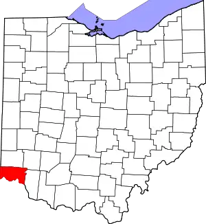 Map of Ohio highlighting Hamilton County | |
| Villages | ||
| Townships | ||
| CDPs |
| |
| Other communities | ||
| Footnotes | ‡This populated place also has portions in an adjacent county or counties | |
This article is issued from Wikipedia. The text is licensed under Creative Commons - Attribution - Sharealike. Additional terms may apply for the media files.