Camp Dennison, Ohio
Camp Dennison is a census-designated place (CDP) just outside Indian Hill in southern Symmes Township, Hamilton County, Ohio, United States. It has a post office with the ZIP code 45111.[5] The population was 384 at the 2010 census.
Camp Dennison, Ohio | |
|---|---|
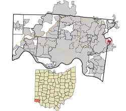 Location in Hamilton County and the state of Ohio. | |
| Coordinates: 39°11′53″N 84°17′19″W | |
| Country | United States |
| State | Ohio |
| County | Hamilton |
| Area | |
| • Total | 0.55 sq mi (1.43 km2) |
| • Land | 0.54 sq mi (1.39 km2) |
| • Water | 0.01 sq mi (0.04 km2) |
| Elevation | 579 ft (176 m) |
| Population (2020) | |
| • Total | 384[3] |
| • Density | 716.42/sq mi (276.78/km2) |
| Time zone | UTC-5 (Eastern (EST)) |
| • Summer (DST) | UTC-4 (EDT) |
| ZIP code | 45111 |
| FIPS code | 39-11150[4] |
| GNIS feature ID | 1056758[2] |
History
The community was settled in 1796 by German immigrants.[6] During the American Civil War, Camp Dennison served as a military recruiting and training post for the United States Army (see Camp Dennison). It is named for William Dennison, the 24th Governor of Ohio and U.S. Postmaster General under President Abraham Lincoln.
Geography
Camp Dennison is located at 39°11′53″N 84°17′19″W[7] in the valley of the Little Miami River, 17 miles (27 km) northeast of downtown Cincinnati. Ohio State Route 126, Glendale Milford Road, runs north-south through the center of the community.
According to the United States Census Bureau, the CDP has a total area of 0.39 square miles (1.0 km2), all land.[8]
Education
Residents of Camp Dennison have access to Indian Hill Exempted Village School District.
References
- "ArcGIS REST Services Directory". United States Census Bureau. Retrieved September 20, 2022.
- "US Board on Geographic Names". United States Geological Survey. October 25, 2007. Retrieved January 31, 2008.
- "Census of Population and Housing". Census.gov. Retrieved June 4, 2016.
- "U.S. Census website". United States Census Bureau. Retrieved January 31, 2008.
- USPS – Cities by ZIP Code
- Bennett, Mary Beth (November 2005). "Intersection Camp Dennison". Cincinnati Magazine. p. 42. Retrieved May 8, 2013.
- "US Gazetteer files: 2010, 2000, and 1990". United States Census Bureau. February 12, 2011. Retrieved April 23, 2011.
- "Geographic Identifiers: 2010 Demographic Profile Data (G001): Camp Dennison CDP, Ohio". U.S. Census Bureau, American Factfinder. Archived from the original on February 12, 2020. Retrieved November 13, 2012.
Municipalities and communities of Hamilton County, Ohio, United States | ||
|---|---|---|
| Cities | 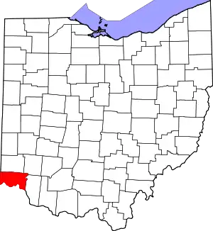 Map of Ohio highlighting Hamilton County | |
| Villages | ||
| Townships | ||
| CDPs |
| |
| Other communities | ||
| Footnotes | ‡This populated place also has portions in an adjacent county or counties | |