Reipertswiller
Reipertswiller (French pronunciation: [ʁaipɛʁtswilɛʁ]; German: Reipertsweiler) is a commune in the Bas-Rhin department in Grand Est in north-eastern France.[3]
Reipertswiller | |
|---|---|
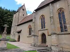 The church in Reipertswiller | |
 Coat of arms | |
Location of Reipertswiller | |
 Reipertswiller 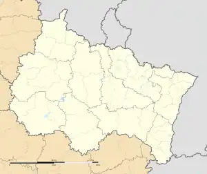 Reipertswiller | |
| Coordinates: 48°55′58″N 7°27′56″E | |
| Country | France |
| Region | Grand Est |
| Department | Bas-Rhin |
| Arrondissement | Saverne |
| Canton | Ingwiller |
| Government | |
| • Mayor (2020–2026) | Samuel Leichtweis[1] |
| Area 1 | 19.21 km2 (7.42 sq mi) |
| Population | 846 |
| • Density | 44/km2 (110/sq mi) |
| Time zone | UTC+01:00 (CET) |
| • Summer (DST) | UTC+02:00 (CEST) |
| INSEE/Postal code | 67392 /67340 |
| Elevation | 207–421 m (679–1,381 ft) |
| 1 French Land Register data, which excludes lakes, ponds, glaciers > 1 km2 (0.386 sq mi or 247 acres) and river estuaries. | |
In 2019, Reipertswiller had 850 inhabitants. It is bordered on the North by Mouterhouse, on the Northeast by Baerenthal, on the Southeast by Lichtenberg, on the Southwest by Wimmenau and in the Northwest by Goetzenbruck.
The commune is part of the Parc naturel régional des Vosges du Nord.
See also
References
- "Répertoire national des élus: les maires". data.gouv.fr, Plateforme ouverte des données publiques françaises (in French). 2 December 2020.
- "Populations légales 2020". The National Institute of Statistics and Economic Studies. 29 December 2022.
- INSEE commune file
Wikimedia Commons has media related to Reipertswiller.
This article is issued from Wikipedia. The text is licensed under Creative Commons - Attribution - Sharealike. Additional terms may apply for the media files.