Bissert
Bissert is a commune in the Bas-Rhin department in Grand Est in northeastern France.[3]
Bissert
Bìssert | |
|---|---|
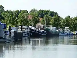 The moorings in Bissert | |
 Coat of arms | |
Location of Bissert | |
 Bissert 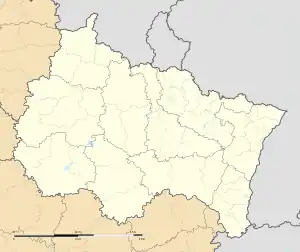 Bissert | |
| Coordinates: 48°56′34″N 7°01′28″E | |
| Country | France |
| Region | Grand Est |
| Department | Bas-Rhin |
| Arrondissement | Saverne |
| Canton | Ingwiller |
| Government | |
| • Mayor (2020–2026) | Francis Schorung[1] |
| Area 1 | 3.37 km2 (1.30 sq mi) |
| Population | 157 |
| • Density | 47/km2 (120/sq mi) |
| Time zone | UTC+01:00 (CET) |
| • Summer (DST) | UTC+02:00 (CEST) |
| INSEE/Postal code | 67047 /67260 |
| Elevation | 213–258 m (699–846 ft) |
| 1 French Land Register data, which excludes lakes, ponds, glaciers > 1 km2 (0.386 sq mi or 247 acres) and river estuaries. | |
Population
| Year | Pop. | ±% |
|---|---|---|
| 1962 | 187 | — |
| 1968 | 190 | +1.6% |
| 1975 | 174 | −8.4% |
| 1982 | 135 | −22.4% |
| 1990 | 133 | −1.5% |
| 1999 | 157 | +18.0% |
| 2006 | 149 | −5.1% |
| 2009 | 143 | −4.0% |
See also
References
- "Répertoire national des élus: les maires". data.gouv.fr, Plateforme ouverte des données publiques françaises (in French). 2 December 2020.
- "Populations légales 2020". The National Institute of Statistics and Economic Studies. 29 December 2022.
- INSEE commune file
Wikimedia Commons has media related to Bissert.
This article is issued from Wikipedia. The text is licensed under Creative Commons - Attribution - Sharealike. Additional terms may apply for the media files.