Saint-Léger-sous-Cholet
Saint-Léger-sous-Cholet (French pronunciation: [sɛ̃ leʒe su ʃɔlɛ] ⓘ, literally Saint-Léger under Cholet) is a commune in the Maine-et-Loire department in western France.[3]
Saint-Léger-sous-Cholet | |
|---|---|
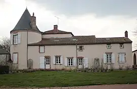 The town hall of Saint-Léger-sous-Cholet | |
 Coat of arms | |
Location of Saint-Léger-sous-Cholet | |
 Saint-Léger-sous-Cholet  Saint-Léger-sous-Cholet | |
| Coordinates: 47°05′35″N 0°54′29″W | |
| Country | France |
| Region | Pays de la Loire |
| Department | Maine-et-Loire |
| Arrondissement | Cholet |
| Canton | Sèvremoine |
| Intercommunality | CA Choletais |
| Government | |
| • Mayor (2020–2026) | Jean-Paul Olivares[1] |
| Area 1 | 9.72 km2 (3.75 sq mi) |
| Population | 3,062 |
| • Density | 320/km2 (820/sq mi) |
| Time zone | UTC+01:00 (CET) |
| • Summer (DST) | UTC+02:00 (CEST) |
| INSEE/Postal code | 49299 /49280 |
| Elevation | 93–132 m (305–433 ft) |
| 1 French Land Register data, which excludes lakes, ponds, glaciers > 1 km2 (0.386 sq mi or 247 acres) and river estuaries. | |
History
Before the French Revolution, the town and the north of the village (Haut-Saint-Léger) depended on Le May-sur-Èvre, the south (Bas-Saint-Léger) on Mortagne-sur-Sèvre.
The town was created by decree of Emperor Napoleon III on December 14, 1863, its territory was then a section of the town of Le May-sur-Evre.
From 1899 to 1947, the town was crossed by the Petit Anjou railway line (Cholet-Nantes, via Beaupréau and Le Loroux-Bottereau) which had a station there.
References
- "Répertoire national des élus: les maires". data.gouv.fr, Plateforme ouverte des données publiques françaises (in French). 2 December 2020.
- "Populations légales 2020". The National Institute of Statistics and Economic Studies. 29 December 2022.
- INSEE commune file
Wikimedia Commons has media related to Saint-Léger-sous-Cholet.
This article is issued from Wikipedia. The text is licensed under Creative Commons - Attribution - Sharealike. Additional terms may apply for the media files.