Saint-Cirgues-de-Jordanne
Saint-Cirgues-de-Jordanne (French pronunciation: [sɛ̃ siʁɡ də ʒɔʁdan]; Occitan: Sant Cirgue de Jordana) is a commune in the Cantal department in south-central France.
Saint-Cirgues-de-Jordanne | |
|---|---|
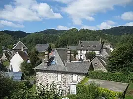 A general view of Saint-Cirgues-de-Jordanne | |
Location of Saint-Cirgues-de-Jordanne | |
 Saint-Cirgues-de-Jordanne  Saint-Cirgues-de-Jordanne | |
| Coordinates: 45°01′45″N 2°34′59″E | |
| Country | France |
| Region | Auvergne-Rhône-Alpes |
| Department | Cantal |
| Arrondissement | Aurillac |
| Canton | Vic-sur-Cère |
| Intercommunality | CA Bassin d'Aurillac |
| Government | |
| • Mayor (2020–2026) | Philippe Maurs[1] |
| Area 1 | 16.24 km2 (6.27 sq mi) |
| Population | 143 |
| • Density | 8.8/km2 (23/sq mi) |
| Time zone | UTC+01:00 (CET) |
| • Summer (DST) | UTC+02:00 (CEST) |
| INSEE/Postal code | 15178 /15590 |
| Elevation | 733–1,520 m (2,405–4,987 ft) (avg. 800 m or 2,600 ft) |
| 1 French Land Register data, which excludes lakes, ponds, glaciers > 1 km2 (0.386 sq mi or 247 acres) and river estuaries. | |
Population
| Year | Pop. | ±% |
|---|---|---|
| 1962 | 285 | — |
| 1968 | 293 | +2.8% |
| 1975 | 249 | −15.0% |
| 1982 | 223 | −10.4% |
| 1990 | 199 | −10.8% |
| 1999 | 176 | −11.6% |
| 2008 | 144 | −18.2% |
| 2016 | 133 | −7.6% |
See also
References
- "Répertoire national des élus: les maires". data.gouv.fr, Plateforme ouverte des données publiques françaises (in French). 2 December 2020.
- "Populations légales 2020". The National Institute of Statistics and Economic Studies. 29 December 2022.
Wikimedia Commons has media related to Saint-Cirgues-de-Jordanne.
This article is issued from Wikipedia. The text is licensed under Creative Commons - Attribution - Sharealike. Additional terms may apply for the media files.