La Chapelle-du-Châtelard
La Chapelle-du-Châtelard (French pronunciation: [la ʃapɛl dy ʃatlaʁ]) is a commune in the Ain department in eastern France.
La Chapelle-du-Châtelard | |
|---|---|
Commune | |
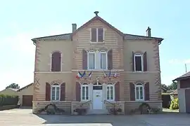 Town hall | |
Location of La Chapelle-du-Châtelard | |
 La Chapelle-du-Châtelard  La Chapelle-du-Châtelard | |
| Coordinates: 46°04′11″N 5°01′34″E | |
| Country | France |
| Region | Auvergne-Rhône-Alpes |
| Department | Ain |
| Arrondissement | Bourg-en-Bresse |
| Canton | Châtillon-sur-Chalaronne |
| Intercommunality | Dombes |
| Government | |
| • Mayor (2020–2026) | Cyrille Rimaud[1] |
| Area 1 | 13.37 km2 (5.16 sq mi) |
| Population | 397 |
| • Density | 30/km2 (77/sq mi) |
| Time zone | UTC+01:00 (CET) |
| • Summer (DST) | UTC+02:00 (CEST) |
| INSEE/Postal code | 01085 /01240 |
| Elevation | 236–285 m (774–935 ft) (avg. 266 m or 873 ft) |
| 1 French Land Register data, which excludes lakes, ponds, glaciers > 1 km2 (0.386 sq mi or 247 acres) and river estuaries. | |
Geography
The Chalaronne forms the commune's southeastern border, flows northwest through the northern part of the commune, then forms part of its northwestern border.
Population
| Year | Pop. | ±% p.a. |
|---|---|---|
| 1968 | 210 | — |
| 1975 | 202 | −0.55% |
| 1982 | 242 | +2.61% |
| 1990 | 247 | +0.26% |
| 1999 | 263 | +0.70% |
| 2007 | 310 | +2.08% |
| 2012 | 363 | +3.21% |
| 2017 | 388 | +1.34% |
| Source: INSEE[3] | ||
See also
References
- "Répertoire national des élus: les maires". data.gouv.fr, Plateforme ouverte des données publiques françaises (in French). 2 December 2020.
- "Populations légales 2020". The National Institute of Statistics and Economic Studies. 29 December 2022.
- Population en historique depuis 1968, INSEE
Wikimedia Commons has media related to La Chapelle-du-Châtelard.
This article is issued from Wikipedia. The text is licensed under Creative Commons - Attribution - Sharealike. Additional terms may apply for the media files.