Brénod
Brénod (French pronunciation: [bʁeno] ⓘ) is a commune in the Ain department in eastern France
Brénod | |
|---|---|
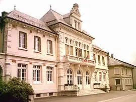 Town hall | |
.svg.png.webp) Coat of arms | |
Location of Brénod | |
 Brénod  Brénod | |
| Coordinates: 46°03′39″N 5°36′22″E | |
| Country | France |
| Region | Auvergne-Rhône-Alpes |
| Department | Ain |
| Arrondissement | Nantua |
| Canton | Plateau d'Hauteville |
| Intercommunality | Haut-Bugey Agglomération |
| Government | |
| • Mayor (2020–2026) | Étienne Ravot[1] |
| Area 1 | 23.79 km2 (9.19 sq mi) |
| Population | 486 |
| • Density | 20/km2 (53/sq mi) |
| Time zone | UTC+01:00 (CET) |
| • Summer (DST) | UTC+02:00 (CEST) |
| INSEE/Postal code | 01060 /01110 |
| Elevation | 831–1,136 m (2,726–3,727 ft) (avg. 853 m or 2,799 ft) |
| 1 French Land Register data, which excludes lakes, ponds, glaciers > 1 km2 (0.386 sq mi or 247 acres) and river estuaries. | |
Geography
The commune is located 70 km (43 mi) northeast of Lyon.
The river Albarine rises in the commune's northern part, then flows south through the commune; the village lies on the right bank of the river.
Population
| Year | Pop. | ±% p.a. |
|---|---|---|
| 1968 | 524 | — |
| 1975 | 436 | −2.59% |
| 1982 | 431 | −0.16% |
| 1990 | 385 | −1.40% |
| 1999 | 427 | +1.16% |
| 2007 | 523 | +2.57% |
| 2012 | 543 | +0.75% |
| 2017 | 509 | −1.28% |
| Source: INSEE[3] | ||
See also
References
- "Répertoire national des élus: les maires" (in French). data.gouv.fr, Plateforme ouverte des données publiques françaises. 13 September 2022.
- "Populations légales 2020". The National Institute of Statistics and Economic Studies. 29 December 2022.
- Population en historique depuis 1968, INSEE
Wikimedia Commons has media related to Brénod.
This article is issued from Wikipedia. The text is licensed under Creative Commons - Attribution - Sharealike. Additional terms may apply for the media files.