Bettant
Bettant (French pronunciation: [bɛtɑ̃] ⓘ) is a commune in the Ain department in eastern France.
Bettant | |
|---|---|
Commune | |
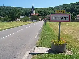 | |
Location of Bettant | |
 Bettant  Bettant | |
| Coordinates: 45°56′00″N 5°22′00″E | |
| Country | France |
| Region | Auvergne-Rhône-Alpes |
| Department | Ain |
| Arrondissement | Belley |
| Canton | Ambérieu-en-Bugey |
| Intercommunality | Plaine de l'Ain |
| Government | |
| • Mayor (2020–2026) | Marie-Françoise Vignollet[1] |
| Area 1 | 3.37 km2 (1.30 sq mi) |
| Population | 748 |
| • Density | 220/km2 (570/sq mi) |
| Time zone | UTC+01:00 (CET) |
| • Summer (DST) | UTC+02:00 (CEST) |
| INSEE/Postal code | 01041 /01500 |
| Elevation | 245–605 m (804–1,985 ft) |
| 1 French Land Register data, which excludes lakes, ponds, glaciers > 1 km2 (0.386 sq mi or 247 acres) and river estuaries. | |
Geography
The village lies in the commune's northwestern part, on the left bank of the river Albarine, which forms most of the commune's northern and eastern borders.
Population
| Year | Pop. | ±% p.a. |
|---|---|---|
| 1968 | 567 | — |
| 1975 | 586 | +0.47% |
| 1982 | 594 | +0.19% |
| 1990 | 703 | +2.13% |
| 1999 | 683 | −0.32% |
| 2007 | 711 | +0.50% |
| 2012 | 739 | +0.78% |
| 2017 | 748 | +0.24% |
| Source: INSEE[3] | ||
See also
References
- "Répertoire national des élus: les maires" (in French). data.gouv.fr, Plateforme ouverte des données publiques françaises. 13 September 2022.
- "Populations légales 2020". The National Institute of Statistics and Economic Studies. 29 December 2022.
- Population en historique depuis 1968, INSEE
External links
Wikimedia Commons has media related to Bettant.
This article is issued from Wikipedia. The text is licensed under Creative Commons - Attribution - Sharealike. Additional terms may apply for the media files.