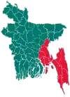
Kachua Upazila, Chandpur
Kachua (Bengali: কচুয়া) is an upazila (sub-district) of Chandpur District in Bangladesh, located in the Chittagong Division.[1] It is a part of the Greater Comilla region.
Kachua
কচুয়া | |
|---|---|
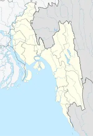 Kachua Location in Bangladesh | |
| Coordinates: 23°21′N 90°53.5′E | |
| Country | |
| Division | Chittagong Division |
| District | Chandpur District |
| Thana | 25 January 1918 |
| Upazila | 1983 |
| Government | |
| • MP (Chandpur-1) | Muhiuddin Khan Alamgir |
| Area | |
| • Total | 235.81 km2 (91.05 sq mi) |
| Population (2011) | |
| • Total | 382,139 |
| • Density | 1,600/km2 (4,200/sq mi) |
| Time zone | UTC+6 (BST) |
| Website | kachua |
History
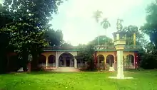
During the reign of the Mughal emperor Bahadur Shah in 1705/1706 CE, the Faujdar (local governor) Bakhtiyar ibn Ilyas Khan built a mosque in Ujania which still stands today. The area was also settled by a wali known as Shah Niamat Shah, who was based on the banks of the Tarini Dighi. People from various places would travel to meet with the Wali, and a haat bazaar later emerged known as Niamat Shaher Bazar (Niamat Shah's bazaar). It is presently known as Kachua Bazar after the establishment of Kachua Thana.[2]
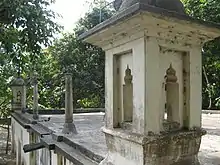
During the time of the administration of the British East India Company, Kachua was a part of the Daudkandi Thana. A large portion of present-day Kachua was under the zamindari of the Munshibari family of Comilla. Abdul Hamid Munshi of this family was responsible for establishing the glorious Taltoli Jama Mosque in the village of Taltoli in 1891.
By the time of Queen Victoria, Kachua was under the Hajiganj Thana. A separate thana was established with the name of Kachua on 25 January 1918 during the reign of George V. There are numerous theories behind the naming of Kachua. One theory suggests that it is of Hindustani origin. It was said that in 1905, the Hajiganj Thana was divided into two parts and survey work was carried out to determine its boundary/area. The survey was conducted under the leadership of a police officer. The survey work started from the southern boundary of Daudkandi Thana i.e. the northern end of present Kachua Upazila. At one stage of the survey, the police officer and other people came to the southern part of the village on the north side adjacent to Kachua Bazar and found some palm trees. They camped for a few days in a high place in this palm tree area which is now known as Dhulikachua village. A local villager by the name of Maulvi Ali Akmat asked how much of the survey work had been done and in reply, the officer said "Kuch Hua" meaning some things have happened. The name Kachua was said to have been derived from "Kuch Hua" according to this incident.[3]
During the Bangladesh Liberation War of 1971, a brawl took place in Raghunathpur Bazar leading to the death of one Bengali freedom fighter and 14 civilians. Kachua Thana was upgraded to an upazila in 1983.[1]
Geography
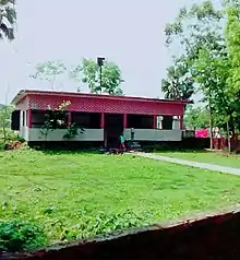
Kachua is located in between 23.15 and 23.28 degrees of North latitudes and 90.48 to 91.01 degrees of East longitudes. ( 23.3500°N 90.8917°E ). It has a total area of 235.82 km2.
Demographics
| Year | Pop. (000) | ±% |
|---|---|---|
| 1981 | 248 | — |
| 1991 | 293 | +18.1% |
| 2001 | 331 | +13.0% |
| 2011 | 382 | +15.4% |
| Source: Bangladesh Bureau of Statistics[4] | ||
According to the 2011 Bangladesh census, Kachua Upazila had 76,642 households and a population of 382,139, 11.5% of the population was under the age of 5. The literacy rate (age 7 and over) was 53.8%, compared to the national average of 51.8%. Kachua upazila has a sex ratio of 1114 females per 1000 males. 27,024 (7.07%) of the population lives in urban areas.[5][6]
Administration
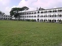
Kachua Upazila is divided into Kachua Municipality and 12 union parishads: Ashrafpur, Bitara, Dakshin Gohat, Dakshin Kachua, Kadla, Karyia, Pashim Sahadebpur, Pathoir, Purba Sahadebpur, Sachar, Uttar Gohat, and Uttar Kachua. The union parishads are subdivided into 158 mauzas and 232 villages.
Kachua Municipality is subdivided into 9 wards and 20 mahallas.[4]
Notable people
Some famous residents of Kachua include:[7]
- Jalal Alamgir (1971-2011), former associate professor of political science University of Massachusetts Boston
- Mohiuddin Khan Alamgir (b. 1942), economist and civil servant
- Burhanuddin Khan Jahangir (1936-2020), writer and educationist
- Muntassir Uddin Khan Mamoon (b. 1951), historian
- A.N.M. Ehsanul Hoque Milan (b. 1957), Bangladesh Nationalist Party politician
- Mesbah Uddin Khan (d. 2006), Awami League politician
- Ibrahim Ujani (1863-1943), qazi and Islamic scholar
References
- Habibunnabi Shariful Haque Shajee (2012). "Kachua Upazila (Chandpur District)". In Sirajul Islam; Miah, Sajahan; Khanam, Mahfuza; Ahmed, Sabbir (eds.). Banglapedia: the National Encyclopedia of Bangladesh (Online ed.). Dhaka, Bangladesh: Banglapedia Trust, Asiatic Society of Bangladesh. ISBN 984-32-0576-6. OCLC 52727562. OL 30677644M. Retrieved 25 October 2023.
- ভাষা ও সংষ্কৃতি [Language and culture]. Kochuya Upazila (in Bengali).
- কচুয়া উপজেলার পটভূমি [Background of Kachua Subdistrict]. Kochua Upazila (in Bengali).
- "District Statistics 2011: Chandpur" (PDF). Bangladesh Bureau of Statistics. Archived from the original (PDF) on 13 November 2014. Retrieved 14 July 2014.
- "Community Report: Chandpur" (PDF). Population & Housing Census 2011. Bangladesh Bureau of Statistics. Retrieved 15 August 2018.
- "Population and Housing Census 2011: Bangladesh at a Glance" (PDF). Bangladesh Bureau of Statistics. Archived from the original (PDF) on 28 July 2014. Retrieved 21 July 2014.
- প্রখ্যাত ব্যক্তিত্ব [Eminent personalities]. Kachua Upazila, Chandpur.
Further reading
- Ahmed, Nasir; Mikail, Mohammad; Saha, DK (2009-05-06). "Mineralogical study of Sediment samples of Kachua, Chandpur district for investigation of arsenic bearing minerals". Journal of Bangladesh Academy of Sciences. 32 (1): 1–12. doi:10.3329/jbas.v32i1.2436. ISSN 0378-8121.
