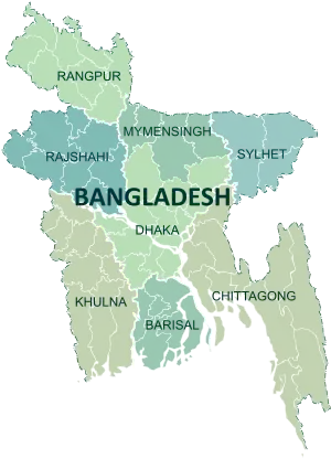
Districts of Bangladesh
The divisions of Bangladesh are divided into 64[1] districts or zila.[2] The headquarters of a district is called a district seat (jela shodor). The districts are further subdivided into 495 subdistricts or upazilas.[3]
| This article is part of a series on the |
| Politics of the People's Republic of Bangladesh |
|---|
 |
|
|
|
|


History
Before independence, Bangladesh (then known as East Pakistan) had 19 districts.
English spelling change
In April 2018, the government changed the English spelling of five districts to avoid inconsistencies in the Bengali and English spellings. The spellings have been changed from Bogra to Bogura, Barisal to Barishal, Jessore to Jashore, Chittagong to Chattogram and Comilla to Cumilla.[4]
Administration
Deputy commissioner
A deputy commissioner (popularly abbreviated to "DC") is the executive head of the district. Deputy commissioners are appointed by the government from the deputy secretary BCS Administration Cadre.
District councils
A district council (or zila parishad) is a local government body at the district level.[5] The Bengali word parishad means council and zila parishad translates to district council.
The functions of a district council include construction and maintenance of roads, and bridges, building hospitals and dispensaries, schools and educational institutions, health facilities and sanitation, tube wells for drinking water, rest houses, and coordination of activities of the Union parishads within the district.
Timeline of creation
- 1666
- 1772
- 1781
- 3 January 1782
- 1786
- 1787
- 1790
- 1797
- 1815
- 1821
- 1832
- 1860
- Hill Tracts district is split from Chittagong district.[6]
- 1882
- Khulna District is split from Jessore district .[19]
- 1947
- Kushtia District is established Because of the Partition of Bengal in 1947 before that it is a part of Nadia District.[20]
- 1969
- Tangail District is split from Mymensingh district.[12]
- Patuakhali district is split from Barisal district.[21]
- 1971
- Dhaka Division: Dhaka district, Faridpur district, Mymensingh district, Tangail district
- Chittagong Division: Hill Tracts district, Chittagong district, Comilla district, Noakhali district, Sylhet district.
- Rajshahi Division: Bogra district, Dinajpur district, Rajshahi district, Rangpur district, Pabna district.
- Khulna Division: Barisal district, Jessore district, Khulna district, Kushtia district, Patuakhali district
- 1978
- Jamalpur District is split from Mymensingh district.[22][12]
- 1983
- Joypurhat District was split from Bogra district.[17]
- 1984
- 22 February
- Magura district was split from Jessore district.
- Brahmanbaria and Chandpur districts were split from Comilla district.[23]
- Sirajganj district was split from Pabna district.[24]
- Sherpur district was split from Jamalpur district.
- Netrokona and Kishoreganj districts were split from Mymensingh district.[12]
- Lakshmipur and Feni districts were split from Noakhali district.[25][26]
- Sunamganj, Habiganj and Maulvibazar districts were split from Sylhet district.[10]
- Thakurgaon and Panchagarh districts were split from Dinajpur district.[11]
- 1 March
- Jhenaidah and Narail split from Jessore district.
- Cox's Bazar district was split from Chittagong district.[27]
- Satkhira and Bagerhat districts were split from Khulna District.
- Meherpur and Chuadanga districts were split from Kustia District.
- Prirojpur and Jhalokati District were spilt from Barisal district.
- Bhola and Barguna District were spilt from Patuakhali district.
List of districts
| District | Division | Established | Area (km2)[28] | Population (2022)[29] | Density (/km2)[29] |
|---|---|---|---|---|---|
| Barguna | Barisal | 1984 | 1,831 | 1,010,530 | 552 |
| Barisal | 1797 | 2,785 | 2,570,450 | 923 | |
| Bhola | 1984 | 3,403 | 1,932,514 | 568 | |
| Jhalokati | 1984 | 707 | 661,161 | 935 | |
| Patuakhali | 1969 | 3,221 | 1,727,254 | 536 | |
| Pirojpur | 1984 | 1,278 | 1,198,193 | 938 | |
| Bandarban | Chittagong | 1981 | 4,479 | 481,109 | 107 |
| Brahmanbaria | 1984 | 1,881 | 3,306,559 | 1,758 | |
| Chandpur | 1984 | 1,645 | 2,635,748 | 1,602 | |
| Chittagong | 1666 | 5,283 | 9,169,464 | 1,736 | |
| Comilla | 1790 | 3,146 | 6,212,216 | 1,974 | |
| Cox's Bazar | 1984 | 2,492 | 2,823,265 | 1,133 | |
| Feni | 1984 | 990 | 1,648,896 | 1,665 | |
| Khagrachhari | 1983 | 2,749 | 714,119 | 260 | |
| Lakshmipur | 1984 | 1,440 | 1,938,111 | 1,346 | |
| Noakhali | 1821 | 3,686 | 3,625,252 | 984 | |
| Rangamati | 1983 | 6,116 | 647,587 | 106 | |
| Dhaka | Dhaka | 1772 | 1,464 | 14,734,025 | 10,067 |
| Faridpur | 1815 | 2,053 | 2,162,876 | 1,054 | |
| Gazipur | 1984 | 1,806 | 5,263,474 | 2,914 | |
| Gopalganj | 1984 | 1,469 | 1,295,053 | 882 | |
| Kishoreganj | 1984 | 2,689 | 3,267,630 | 1,215 | |
| Madaripur | 1984 | 1,125 | 1,293,027 | 1,149 | |
| Manikganj | 1984 | 1,384 | 1,558,024 | 1,126 | |
| Munshiganj | 1984 | 1,004 | 1,625,418 | 1,618 | |
| Narayanganj | 1984 | 684 | 3,909,138 | 5,712 | |
| Narsingdi | 1984 | 1,150 | 2,584,452 | 2,247 | |
| Rajbari | 1984 | 1,092 | 1,189,821 | 1,089 | |
| Shariatpur | 1984 | 1,174 | 1,294,561 | 1,103 | |
| Tangail | 1969 | 3,414 | 4,037,608 | 1,183 | |
| Bagerhat | Khulna | 1984 | 3,959 | 1,613,079 | 407 |
| Chuadanga | 1984 | 1,174 | 1,234,066 | 1,051 | |
| Jessore | 1781 | 2,607 | 3,076,849 | 1,180 | |
| Jhenaidah | 1984 | 1,965 | 2,005,849 | 1,021 | |
| Khulna | 1882 | 4,394 | 2,613,385 | 595 | |
| Kushtia | 1947 | 1,609 | 2,149,692 | 1,336 | |
| Magura | 1984 | 1,039 | 1,033,115 | 994 | |
| Meherpur | 1984 | 742 | 705,356 | 951 | |
| Narail | 1984 | 968 | 788,673 | 815 | |
| Satkhira | 1984 | 3,817 | 2,196,581 | 574 | |
| Jamalpur | Mymensingh | 1978 | 2,115 | 2,499,737 | 1,182 |
| Mymensingh | 1787 | 4,395 | 5,899,052 | 1,342 | |
| Netrokona | 1984 | 2,794 | 2,324,856 | 832 | |
| Sherpur | 1984 | 1,365 | 1,501,853 | 1,101 | |
| Bogra | Rajshahi | 1821 | 2,899 | 3,734,300 | 1,288 |
| Joypurhat | 1983 | 1,012 | 956,430 | 945 | |
| Naogaon | 1984 | 3,436 | 2,784,598 | 811 | |
| Natore | 1984 | 1,900 | 1,859,921 | 979 | |
| Chapai Nawabganj | 1984 | 1,703 | 1,835,527 | 1,078 | |
| Pabna | 1832 | 2,376 | 2,909,622 | 1,225 | |
| Rajshahi | 1772 | 2,425 | 2,915,013 | 1,202 | |
| Sirajganj | 1984 | 2,402 | 3,357,708 | 1,398 | |
| Dinajpur | Rangpur | 1786 | 3,444 | 3,315,238 | 963 |
| Gaibandha | 1984 | 2,115 | 2,562,232 | 1,212 | |
| Kurigram | 1984 | 2,245 | 2,329,161 | 1,037 | |
| Lalmonirhat | 1984 | 1,247 | 1,428,406 | 1,145 | |
| Nilphamari | 1984 | 1,547 | 2,092,567 | 1,353 | |
| Panchagarh | 1984 | 1,405 | 1,179,843 | 840 | |
| Rangpur | 1772 | 2,401 | 3,169,615 | 1,320 | |
| Thakurgaon | 1984 | 1,781 | 1,533,894 | 861 | |
| Habiganj | Sylhet | 1984 | 2,637 | 2,358,886 | 895 |
| Moulvibazar | 1984 | 2,799 | 2,123,445 | 759 | |
| Sunamganj | 1984 | 3,747 | 2,695,495 | 719 | |
| Sylhet | 1782 | 3,452 | 3,857,037 | 1,117 | |
| Total | 147,570 | 165,158,616 | 1,119 | ||
References
- "People's Republic of Bangladesh". Bangladesh National Portal.
- "Bangladesh - Government and society". Encyclopedia Britannica. Retrieved 10 April 2021.
- "Upazilla List". Bangladesh National Portal. Retrieved 10 April 2021.
- "English spelling of five districts changed". The Independent. Dhaka. 3 April 2018. Retrieved 20 November 2018.
- Kamal Siddiqui. "Local Government". In Sirajul Islam (ed.). Banglapedia: National Encyclopedia of Bangladesh. Asiatic Society of Bangladesh.
- Harun, Jasim (2012). "Chittagong District". In Islam, Sirajul; Jamal, Ahmed A. (eds.). Banglapedia: National Encyclopedia of Bangladesh (Second ed.). Asiatic Society of Bangladesh.
- খান, শামসুজ্জামান (2014). আব্দুল জলিল, মুহম্মদ (ed.). বাংলাদেশ লোকজ সংস্কৃতি গ্রন্থমালা : রংপুর. বাংলা একাডেমি.
- Rahman, Md. (2012). "Rajshahi District". In Islam, Sirajul; Jamal, Ahmed A. (eds.). Banglapedia: National Encyclopedia of Bangladesh (Second ed.). Asiatic Society of Bangladesh.
- Siddiqui, Mahibullah (2012). "Jessore District". In Islam, Sirajul; Jamal, Ahmed A. (eds.). Banglapedia: National Encyclopedia of Bangladesh (Second ed.). Asiatic Society of Bangladesh.
- Hossain, Ashfaq (2012). "Sylhet District". In Islam, Sirajul; Jamal, Ahmed A. (eds.). Banglapedia: National Encyclopedia of Bangladesh (Second ed.). Asiatic Society of Bangladesh.
- Hossain, Ashfaq (2012). "Dinajpur District". In Islam, Sirajul; Jamal, Ahmed A. (eds.). Banglapedia: National Encyclopedia of Bangladesh (Second ed.). Asiatic Society of Bangladesh.
- এক নজরে জেলা [District at a Glance]. Mymensingh District (in Bengali). Retrieved 19 July 2019.
- Siddiqi, Mamun (2012). "Comilla District". In Islam, Sirajul; Jamal, Ahmed A. (eds.). Banglapedia: National Encyclopedia of Bangladesh (Second ed.). Asiatic Society of Bangladesh.
- Islam, KAM (2012). "Barisal District". In Islam, Sirajul; Jamal, Ahmed A. (eds.). Banglapedia: National Encyclopedia of Bangladesh (Second ed.). Asiatic Society of Bangladesh.
- Reza, Masud (2012). "Faridpur District". In Islam, Sirajul; Jamal, Ahmed A. (eds.). Banglapedia: National Encyclopedia of Bangladesh (Second ed.). Asiatic Society of Bangladesh.
- Lipi, Jahanara (2012). "Noakhali District". In Islam, Sirajul; Jamal, Ahmed A. (eds.). Banglapedia: National Encyclopedia of Bangladesh (Second ed.). Asiatic Society of Bangladesh.
- Haq, Md (2012). "Bogra District". In Islam, Sirajul; Jamal, Ahmed A. (eds.). Banglapedia: National Encyclopedia of Bangladesh (Second ed.). Asiatic Society of Bangladesh.
- Alam, Md (2012). "Pabna District". In Islam, Sirajul; Jamal, Ahmed A. (eds.). Banglapedia: National Encyclopedia of Bangladesh (Second ed.). Asiatic Society of Bangladesh.
- Mallik, Sandipak (2012). "Khulna District". In Islam, Sirajul; Jamal, Ahmed A. (eds.). Banglapedia: National Encyclopedia of Bangladesh (Second ed.). Asiatic Society of Bangladesh.
- "Kushtia District". Banglapedia. Retrieved 10 April 2021.
- Jerin, Iffat (2012). "Patuakhali District". In Islam, Sirajul; Jamal, Ahmed A. (eds.). Banglapedia: National Encyclopedia of Bangladesh (Second ed.). Asiatic Society of Bangladesh.
- "Jamalpur District". Banglapedia. Retrieved 10 April 2021.
- "Brahmanbaria District". Banglapedia. Retrieved 10 April 2021.
- "Sirajganj District". Banglapedia. Retrieved 10 April 2021.
- "Lakshmipur District". Banglapedia. Retrieved 10 April 2021.
- "Feni District". Banglapedia. Retrieved 10 April 2021.
- Siddiqi, Mohammad (2012). "Cox's_Bazar District". In Islam, Sirajul; Jamal, Ahmed A. (eds.). Banglapedia: National Encyclopedia of Bangladesh (Second ed.). Asiatic Society of Bangladesh.
- "Table 3.2.3: Area, Number of Household, Enumerated Population and Density with Rank by Division and Zila, 2011" (PDF). bbs.gov.bd. Population and Housing Census 2011 National Report - Volume 1. Bangladesh Bureau of Statistics. 2011. pp. 27–28.
- Population and Housing Census 2022: Preliminary Report. Bangladesh Bureau of Statistics. August 2022. pp. 45–46. ISBN 978-984-35-2977-0.