Belcarra Regional Park
təmtəmíxʷtən/Belcarra Regional Park is a 1,100-hectare (2,700-acre) regional park located in Belcarra, Greater Vancouver, British Columbia.[1] It is northeast of the meeting of Burrard Inlet with Indian Arm, beginning near Belcarra Bay and extending to Sasamat Lake. Sasamat is one of the warmest lakes in Greater Vancouver. The park is northwest of the Village of Anmore and to the southwest of Buntzen Lake.
| təmtəmíxʷtən/Belcarra Regional Park | |
|---|---|
| Belcarra Regional Park | |
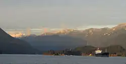 təmtəmíxʷtən/Belcarra Regional Park from Westridge Terminal. Eagle Ridge in the background, with part of Mamquam Mountain, which lies east of Squamish, visible at left rear. | |
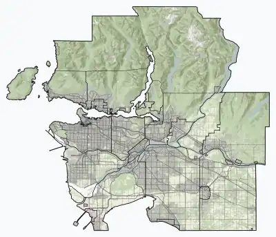 Location of təmtəmíxʷtən/Belcarra Regional Park in Metro Vancouver | |
| Location | British Columbia, Canada |
| Nearest city | Belcarra, British Columbia |
| Coordinates | 49.3184°N 122.8936°W |
| Area | 1,100 hectares (2,700 acres) |
| Operated by | Metro Vancouver Regional District |
| Website | metrovancouver |
Included in the park is a First Nations archaeological site, which is operated and maintained by Metro Vancouver Regional Parks.[2]
In October 2021, the park was renamed from "Belcarra Regional Park" to "təmtəmíxʷtən/Belcarra Regional Park", which means "biggest place for all the people", to reflect the history of the Tsleil-Waututh people who are indigenous to the area.[3][4]
References
- Belcarra Regional Park Metro Vancouver
- Sydney Charlton (1977). "The archaeology of the Belcarra Park site : a contribution to Strait of Georgia prehistory".
- "Metro Vancouver park renamed to reflect Indigenous history". CTV News Vancouver. Retrieved 18 October 2021.
- "Belcarra Regional Park to Become təmtəmíxʷtən/Belcarra Regional Park". Metro Vancouver. 8 October 2021. Retrieved 24 March 2021.
External links