Wittmann, Arizona
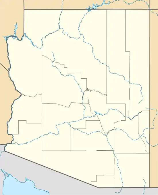
Wittmann is an unincorporated community and census-designated place (CDP) in Maricopa County, Arizona, United States. As of the 2020 census, it had a population of 684,[2] down from 763 in 2010. It is located along U.S. Route 60 in the central part of Arizona, 35 miles (56 km) northwest of central Phoenix, and is part of the Phoenix metropolitan area, although just outside the urban portion.
Wittmann, Arizona | |
|---|---|
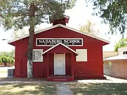 Nadaburg School House | |
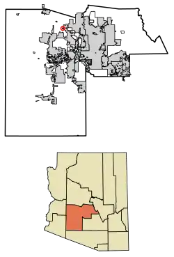 Location in Maricopa County, Arizona | |
 Wittmann  Wittmann | |
| Coordinates: 33°46′30″N 112°31′30″W | |
| Country | United States |
| State | Arizona |
| County | Maricopa |
| Area | |
| • Total | 0.96 sq mi (2.50 km2) |
| • Land | 0.96 sq mi (2.50 km2) |
| • Water | 0.00 sq mi (0.00 km2) |
| Elevation | 1,683 ft (513 m) |
| Population | |
| • Total | 684 |
| • Density | 708.81/sq mi (273.76/km2) |
| Time zone | UTC-7 (Mountain (MST)) |
| ZIP code | 85361 |
| Area code | 623 |
| FIPS code | 04-84140 |
| GNIS feature ID | 2582909 |
A variant name was "Nadaburg"; the present name is for Joseph Wittmann and his wife Eleanor van Beuren Wittmann, a couple who attempted several times to get approvals to build a dam project in nearby Box Canyon that would have benefitted the town. This was to be a successor to the poorly engineered Walnut Grove dam that had collapsed in February 1890, less than two years after it had filled. Eleanor van Beuren's father was the nominal head of a group of East Coast investors that had funded what was then primarily a placer mining project. One of the Walnut Grove Water Storage Company's engineers (not responsible for the design) was Lieutenant Colonel Alexander Oswald Brodie, who was later appointed Arizona's territorial governor.
Governmental approval and adequate funding lacking, the replacement dam project plans faltered. A long-projected time for repayment of supplemental government funding killed Joseph Wittmann's project in the 1940s, leaving promises to Maricopa County families broken.
The naming of nearby Morristown also refers to the Wittmann and van Beuren families, for they had residences in Morristown, New Jersey.
History
The town was first named "Nadaburg", which is a combination of two words, the Spanish word "Nada", which means "nothing" and the German word "burg", which means "castle". The Southern Transcontinental Railroad named the site Nadaburg years before the area was formally opened to homesteading as a result of the Department of Interior Act of December 29, 1916.[3][4]
William Hovey Griffin, a native of Texas, founded the town of Nadaburg (Wittmann). He filed his homestead petition in September 1920. That same year he also plotted out the town site. Griffin donated a block of land to the Maricopa County School District where the little Red School House (it was white at that time) was built. The school currently serves as the Nadaburg Unified School District Governing Board's Boardroom.[3][4]
Joseph Wittmann, continuing a legacy initiated by his father-in-law, endeavored to build a dam on the Hassayampa River, which would bring irrigation water to the town of Nadaburg. In 1926, lots and acreage were given to Wittmann, by the citizens of Nadaburg, in support of the construction of the dam. In 1930, the people of Nadaburg changed the name of the town to Wittmann, honoring the family who promised them the water that would irrigate their fields. Other land and claims included those that had belonged to the Wittmann-van Beuren family ever since the Walnut Grove Water Storage Company went into receivership in the 1890s.[5] However, unable and/or ill-equipped to keep his family's promise, Joseph Wittmann and his son Joseph, Jr. were sued by the citizens of the town; at least half of them were able to recover their lands.[3][4]
Demographics
| Census | Pop. | Note | %± |
|---|---|---|---|
| 2010 | 763 | — | |
| 2020 | 684 | −10.4% | |
| U.S. Decennial Census[6] | |||
As of the census[7] of 2010, there were 763 people living in the Wittmann census-designated place.[2] The population density was 56.3 people per square mile. The racial makeup of Wittmann was 83.8% White, 0.8% Black or African American, 1.2% Native American, 0.5% Asian, 0.1% Pacific Islander, 10.6% from other races, and 3.0% from two or more races. 24.0% of the population were Hispanic or Latino of any race.
Climate
According to the Köppen Climate Classification system, Wittmann has a hot desert climate, abbreviated "BWh" on climate maps. The hottest temperature recorded in Wittmann was 119 °F (48.3 °C) on June 28, 2013 and June 20, 2017, while the coldest temperature recorded was 12 °F (−11.1 °C) on January 13, 1963.[8]
| Climate data for Wittmann, Arizona, 1991–2020 normals, extremes 1930–2020 | |||||||||||||
|---|---|---|---|---|---|---|---|---|---|---|---|---|---|
| Month | Jan | Feb | Mar | Apr | May | Jun | Jul | Aug | Sep | Oct | Nov | Dec | Year |
| Record high °F (°C) | 84 (29) |
90 (32) |
98 (37) |
104 (40) |
112 (44) |
119 (48) |
117 (47) |
115 (46) |
113 (45) |
103 (39) |
91 (33) |
83 (28) |
119 (48) |
| Average high °F (°C) | 65.2 (18.4) |
68.2 (20.1) |
74.9 (23.8) |
82.1 (27.8) |
91.8 (33.2) |
101.8 (38.8) |
104.6 (40.3) |
103.3 (39.6) |
97.6 (36.4) |
86.5 (30.3) |
74.1 (23.4) |
64.1 (17.8) |
84.5 (29.2) |
| Daily mean °F (°C) | 52.2 (11.2) |
54.8 (12.7) |
60.3 (15.7) |
66.3 (19.1) |
75.9 (24.4) |
85.5 (29.7) |
90.7 (32.6) |
90.1 (32.3) |
83.7 (28.7) |
71.8 (22.1) |
59.9 (15.5) |
51.5 (10.8) |
70.2 (21.2) |
| Average low °F (°C) | 39.2 (4.0) |
41.4 (5.2) |
45.6 (7.6) |
50.6 (10.3) |
59.9 (15.5) |
69.1 (20.6) |
76.8 (24.9) |
76.9 (24.9) |
69.8 (21.0) |
57.1 (13.9) |
45.8 (7.7) |
39.0 (3.9) |
55.9 (13.3) |
| Record low °F (°C) | 12 (−11) |
17 (−8) |
25 (−4) |
32 (0) |
34 (1) |
49 (9) |
58 (14) |
60 (16) |
46 (8) |
29 (−2) |
23 (−5) |
22 (−6) |
12 (−11) |
| Average precipitation inches (mm) | 1.38 (35) |
1.45 (37) |
1.00 (25) |
0.45 (11) |
0.09 (2.3) |
0.07 (1.8) |
0.89 (23) |
1.13 (29) |
1.06 (27) |
0.66 (17) |
0.67 (17) |
0.95 (24) |
9.60 (244) |
| Average precipitation days (≥ 0.01 in) | 3.9 | 4.2 | 2.5 | 1.4 | 0.8 | 0.3 | 5.2 | 4.9 | 3.4 | 2.3 | 2.3 | 4.3 | 35.5 |
| Source 1: NOAA[9] | |||||||||||||
| Source 2: National Weather Service[8] | |||||||||||||
Images
 Wittmann Fire Station on Patton Road
 Early Nadaburg church, now the Assembly of God, built c. 1930, and located at 32858 Center Street.
 Wittmann Cemetery at 21307 Galvin Street. The first recorded burial was that of James Stalnaker in 1917.
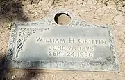 Grave of William Hovey Griffin (1875–1956) in West Resthaven Park Cemetery and Funeral Home, Glendale
References
- "2021 U.S. Gazetteer Files: Arizona". United States Census Bureau. Retrieved May 18, 2022.
- "Wittmann CDP, Arizona: 2020 DEC Redistricting Data (PL 94-171)". U.S. Census Bureau. Retrieved May 18, 2022.
- History of Nadaburg
- "A brief history of a tiny western town" by: Rock Betu
- "Liggett" (PDF). Retrieved October 28, 2019.
- "Census of Population and Housing". Census.gov. Retrieved June 4, 2016.
- "American FactFinder - Community Facts". Archived from the original on February 13, 2020. Retrieved August 5, 2015.
- "NOAA Online Weather Data – NWS Phoenix". National Weather Service. Retrieved April 30, 2023.
- "U.S. Climate Normals Quick Access – Station: Wittmann 1SE, AZ". National Oceanic and Atmospheric Administration. Retrieved April 30, 2023.
External links
![]() Media related to Wittmann, Arizona at Wikimedia Commons
Media related to Wittmann, Arizona at Wikimedia Commons
Municipalities and communities of Maricopa County, Arizona, United States | ||
|---|---|---|
| Cities |  | |
| Towns | ||
| CDPs | ||
| Populated places |
| |
| Indian reservations | ||
| Ghost towns/ former populated places | ||
| Footnotes | ‡This populated place also has portions in an adjacent county or counties | |