Vervins
Vervins (French pronunciation: [vɛʁvɛ̃]; Dutch: Wervin) is a commune in the Aisne department in Hauts-de-France in northern France. It is a subprefecture of the department. It lies between the small streams Vilpion and Chertemps, which drain towards the Serre.[3] It is surrounded by the communes of Fontaine-lès-Vervins, La Bouteille, Landouzy-la-Cour, Thenailles, Hary, Gercy, and Voulpaix. Its population is 2,502 (2015).[4]
Vervins | |
|---|---|
Subprefecture | |
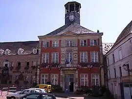 Town hall | |
 Coat of arms | |
Location of Vervins | |
 Vervins  Vervins | |
| Coordinates: 49°50′09″N 3°54′36″E | |
| Country | France |
| Region | Hauts-de-France |
| Department | Aisne |
| Arrondissement | Vervins |
| Canton | Vervins |
| Intercommunality | Thiérache du Centre |
| Government | |
| • Mayor (2020–2026) | Jean-Marc Prince[1] |
| Area 1 | 10.35 km2 (4.00 sq mi) |
| Population | 2,600 |
| • Density | 250/km2 (650/sq mi) |
| Time zone | UTC+01:00 (CET) |
| • Summer (DST) | UTC+02:00 (CEST) |
| INSEE/Postal code | 02789 /02140 |
| Elevation | 120–208 m (394–682 ft) (avg. 147 m or 482 ft) |
| 1 French Land Register data, which excludes lakes, ponds, glaciers > 1 km2 (0.386 sq mi or 247 acres) and river estuaries. | |
Vervins was mentioned as Verbinum in the 3rd century Antonine Itinerary. A Roman theatre has been excavated in the 1870s.[5] The Peace of Vervins was signed here in 1598, ending a war between France and Spain.
Population
|
| ||||||||||||||||||||||||||||||||||||||||||||||||||||||||||||||||||||||||||||||||||||||||||||||||||||||||||||||||||
| Source: EHESS[6] and INSEE (1968-2017)[7] | |||||||||||||||||||||||||||||||||||||||||||||||||||||||||||||||||||||||||||||||||||||||||||||||||||||||||||||||||||
See also
References
- "Répertoire national des élus: les maires". data.gouv.fr, Plateforme ouverte des données publiques françaises (in French). 2 December 2020.
- "Populations légales 2020". The National Institute of Statistics and Economic Studies. 29 December 2022.
- Sandre. "Fiche cours d'eau - Vilpion (H01-0410)".
- Commune de Vervins, INSEE
- Benjamin Saint Jean Vitus (1999). "Vervins". Revue archéologique de Picardie. 16: 139. Retrieved 16 November 2018.
- Des villages de Cassini aux communes d'aujourd'hui: Commune data sheet Vervins, EHESS (in French).
- Population en historique depuis 1968, INSEE
Wikimedia Commons has media related to Vervins.
This article is issued from Wikipedia. The text is licensed under Creative Commons - Attribution - Sharealike. Additional terms may apply for the media files.