Mont-Saint-Jean, Aisne
Mont-Saint-Jean (French pronunciation: [mɔ̃ sɛ̃ ʒɑ̃]) is a commune in the Aisne department in Hauts-de-France in northern France.
Mont-Saint-Jean | |
|---|---|
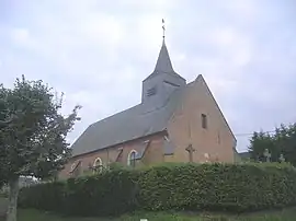 The church of Mont-Saint-Jean | |
Location of Mont-Saint-Jean | |
 Mont-Saint-Jean  Mont-Saint-Jean | |
| Coordinates: 49°47′26″N 4°12′28″E | |
| Country | France |
| Region | Hauts-de-France |
| Department | Aisne |
| Arrondissement | Vervins |
| Canton | Hirson |
| Intercommunality | CC Trois Rivières |
| Government | |
| • Mayor (2020–2026) | Patrick Feuillet[1] |
| Area 1 | 3.95 km2 (1.53 sq mi) |
| Population | 73 |
| • Density | 18/km2 (48/sq mi) |
| Time zone | UTC+01:00 (CET) |
| • Summer (DST) | UTC+02:00 (CEST) |
| INSEE/Postal code | 02522 /02360 |
| Elevation | 192–266 m (630–873 ft) (avg. 243 m or 797 ft) |
| 1 French Land Register data, which excludes lakes, ponds, glaciers > 1 km2 (0.386 sq mi or 247 acres) and river estuaries. | |
Population
| Year | Pop. | ±% |
|---|---|---|
| 1962 | 119 | — |
| 1968 | 96 | −19.3% |
| 1975 | 82 | −14.6% |
| 1982 | 77 | −6.1% |
| 1990 | 82 | +6.5% |
| 1999 | 76 | −7.3% |
| 2008 | 69 | −9.2% |
See also
References
- "Répertoire national des élus: les maires". data.gouv.fr, Plateforme ouverte des données publiques françaises (in French). 2 December 2020.
- "Populations légales 2020". The National Institute of Statistics and Economic Studies. 29 December 2022.
Wikimedia Commons has media related to Mont-Saint-Jean, Aisne.
This article is issued from Wikipedia. The text is licensed under Creative Commons - Attribution - Sharealike. Additional terms may apply for the media files.