Urtaca
Urtaca (Italian pronunciation: [urˈtaːka], Corsican: Ùrtaca) is a commune in the French department of Haute-Corse, on the island of Corsica.
Urtaca | |
|---|---|
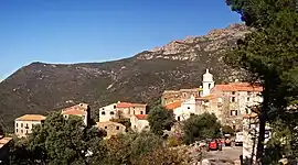 A panorama of the village of Urtaca | |
Location of Urtaca | |
 Urtaca 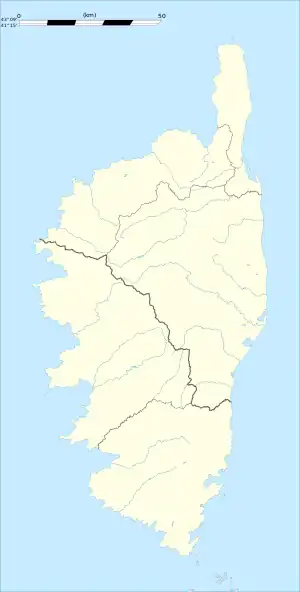 Urtaca | |
| Coordinates: 42°35′39″N 9°10′03″E | |
| Country | France |
| Region | Corsica |
| Department | Haute-Corse |
| Arrondissement | Calvi |
| Canton | L'Île-Rousse |
| Government | |
| • Mayor (2020–2026) | Paul-Vincent Ferrandi[1] |
| Area 1 | 31.26 km2 (12.07 sq mi) |
| Population | 238 |
| • Density | 7.6/km2 (20/sq mi) |
| Time zone | UTC+01:00 (CET) |
| • Summer (DST) | UTC+02:00 (CEST) |
| INSEE/Postal code | 2B332 /20218 |
| Elevation | 37–1,367 m (121–4,485 ft) (avg. 380 m or 1,250 ft) |
| 1 French Land Register data, which excludes lakes, ponds, glaciers > 1 km2 (0.386 sq mi or 247 acres) and river estuaries. | |
Geography
Urtaca is located in the north of Corsica at the confluence of the Ostricone and the Fiume di Gargalagne at the foot of 1,018-metre (3,340 ft)-high Mont Vicinasco.
Population
|
|
References
- "Répertoire national des élus: les maires". data.gouv.fr, Plateforme ouverte des données publiques françaises (in French). 2 December 2020.
- "Populations légales 2020". The National Institute of Statistics and Economic Studies. 29 December 2022.
Wikimedia Commons has media related to Urtaca.
This article is issued from Wikipedia. The text is licensed under Creative Commons - Attribution - Sharealike. Additional terms may apply for the media files.