Sant'Andréa-di-Bozio
Sant'Andréa-di-Bozio is a commune in the Haute-Corse department of France on the island of Corsica.
Sant'Andréa-di-Bozio | |
|---|---|
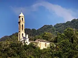 The church of Saint-André, in Sant'Andréa-di-Bozio | |
 Coat of arms | |
Location of Sant'Andréa-di-Bozio | |
 Sant'Andréa-di-Bozio 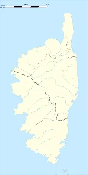 Sant'Andréa-di-Bozio | |
| Coordinates: 42°17′55″N 9°18′12″E | |
| Country | France |
| Region | Corsica |
| Department | Haute-Corse |
| Arrondissement | Corte |
| Canton | Golo-Morosaglia |
| Government | |
| • Mayor (2022–2026) | Jean-Pierre Brunel[1] |
| Area 1 | 24.03 km2 (9.28 sq mi) |
| Population | 66 |
| • Density | 2.7/km2 (7.1/sq mi) |
| Time zone | UTC+01:00 (CET) |
| • Summer (DST) | UTC+02:00 (CEST) |
| INSEE/Postal code | 2B292 /20212 |
| Elevation | 297–1,233 m (974–4,045 ft) (avg. 700 m or 2,300 ft) |
| 1 French Land Register data, which excludes lakes, ponds, glaciers > 1 km2 (0.386 sq mi or 247 acres) and river estuaries. | |
Population
| Year | Pop. | ±% |
|---|---|---|
| 1962 | 96 | — |
| 1968 | 122 | +27.1% |
| 1975 | 106 | −13.1% |
| 1982 | 104 | −1.9% |
| 1990 | 63 | −39.4% |
| 1999 | 76 | +20.6% |
| 2008 | 87 | +14.5% |
References
- "Répertoire national des élus: les maires" (in French). data.gouv.fr, Plateforme ouverte des données publiques françaises. 4 May 2022.
- "Populations légales 2020". The National Institute of Statistics and Economic Studies. 29 December 2022.
Wikimedia Commons has media related to Sant'Andréa-di-Bozio.
This article is issued from Wikipedia. The text is licensed under Creative Commons - Attribution - Sharealike. Additional terms may apply for the media files.