Saint-Michel-de-Montjoie
Saint-Michel-de-Montjoie (French pronunciation: [sɛ̃ miʃɛl də mɔ̃ʒwa]) is a commune in the Manche department in Normandy in north-western France.[3]
Saint-Michel-de-Montjoie | |
|---|---|
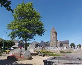 The church and surroundings in Saint-Michel-de-Montjoie | |
.svg.png.webp) Coat of arms | |
Location of Saint-Michel-de-Montjoie | |
 Saint-Michel-de-Montjoie  Saint-Michel-de-Montjoie | |
| Coordinates: 48°45′50″N 1°01′34″W | |
| Country | France |
| Region | Normandy |
| Department | Manche |
| Arrondissement | Avranches |
| Canton | Isigny-le-Buat |
| Intercommunality | CA Mont-Saint-Michel-Normandie |
| Government | |
| • Mayor (2020–2026) | Jocelyne Ozenne[1] |
| Area 1 | 14.46 km2 (5.58 sq mi) |
| Population | 334 |
| • Density | 23/km2 (60/sq mi) |
| Time zone | UTC+01:00 (CET) |
| • Summer (DST) | UTC+02:00 (CEST) |
| INSEE/Postal code | 50525 /50670 |
| Elevation | 185–358 m (607–1,175 ft) (avg. 333 m or 1,093 ft) |
| 1 French Land Register data, which excludes lakes, ponds, glaciers > 1 km2 (0.386 sq mi or 247 acres) and river estuaries. | |
See also
References
- "Répertoire national des élus: les maires" (in French). data.gouv.fr, Plateforme ouverte des données publiques françaises. 13 September 2022.
- "Populations légales 2020". The National Institute of Statistics and Economic Studies. 29 December 2022.
- INSEE commune file
Wikimedia Commons has media related to Saint-Michel-de-Montjoie.
This article is issued from Wikipedia. The text is licensed under Creative Commons - Attribution - Sharealike. Additional terms may apply for the media files.