Montbray
Montbray (French pronunciation: [mɔ̃bʁɛ]) is a commune in the Manche department in Normandy in north-western France.
Montbray | |
|---|---|
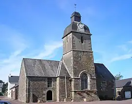 The chapel of Saint-Pierre | |
Location of Montbray | |
 Montbray  Montbray | |
| Coordinates: 48°52′52″N 1°05′40″W | |
| Country | France |
| Region | Normandy |
| Department | Manche |
| Arrondissement | Saint-Lô |
| Canton | Villedieu-les-Poêles-Rouffigny |
| Intercommunality | Villedieu Intercom |
| Government | |
| • Mayor (2020–2026) | Jean-Marie Ligneul[1] |
| Area 1 | 14.04 km2 (5.42 sq mi) |
| Population | 296 |
| • Density | 21/km2 (55/sq mi) |
| Demonym | Montbrayons |
| Time zone | UTC+01:00 (CET) |
| • Summer (DST) | UTC+02:00 (CEST) |
| INSEE/Postal code | 50338 /50410 |
| Elevation | 79–266 m (259–873 ft) (avg. 90 m or 300 ft) |
| 1 French Land Register data, which excludes lakes, ponds, glaciers > 1 km2 (0.386 sq mi or 247 acres) and river estuaries. | |
The village has an ancient château which belongs to the commune and houses the town hall and the village nursery school. The village also has a church, a bar, a bakery, a garage and a children's play area with picnic tables and a pond.
See also
References
- "Répertoire national des élus: les maires". data.gouv.fr, Plateforme ouverte des données publiques françaises (in French). 2 December 2020.
- "Populations légales 2020". The National Institute of Statistics and Economic Studies. 29 December 2022.
Wikimedia Commons has media related to Montbray.
This article is issued from Wikipedia. The text is licensed under Creative Commons - Attribution - Sharealike. Additional terms may apply for the media files.