Saint-Lizier-du-Planté
Saint-Lizier-du-Planté (French pronunciation: [sɛ̃ lizje dy plɑ̃te]; Gascon: Sent Lisièr deu Plantèr) is a commune in the Gers department in southwestern France.
Saint-Lizier-du-Planté | |
|---|---|
Location of Saint-Lizier-du-Planté | |
 Saint-Lizier-du-Planté  Saint-Lizier-du-Planté | |
| Coordinates: 43°24′53″N 0°57′05″E | |
| Country | France |
| Region | Occitania |
| Department | Gers |
| Arrondissement | Auch |
| Canton | Val de Save |
| Intercommunality | Savès |
| Government | |
| • Mayor (2020–2026) | Raymonde Dambielle[1] |
| Area 1 | 10.49 km2 (4.05 sq mi) |
| Population | 146 |
| • Density | 14/km2 (36/sq mi) |
| Time zone | UTC+01:00 (CET) |
| • Summer (DST) | UTC+02:00 (CEST) |
| INSEE/Postal code | 32386 /32220 |
| Elevation | 181–301 m (594–988 ft) |
| 1 French Land Register data, which excludes lakes, ponds, glaciers > 1 km2 (0.386 sq mi or 247 acres) and river estuaries. | |
Geography
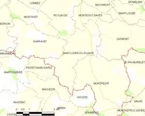
Saint-Lizier-du-Planté and its surrounding communes
Population
| Year | Pop. | ±% |
|---|---|---|
| 1962 | 174 | — |
| 1968 | 152 | −12.6% |
| 1975 | 131 | −13.8% |
| 1982 | 112 | −14.5% |
| 1990 | 120 | +7.1% |
| 1999 | 112 | −6.7% |
| 2008 | 121 | +8.0% |
See also
References
- "Répertoire national des élus: les maires". data.gouv.fr, Plateforme ouverte des données publiques françaises (in French). 2 December 2020.
- "Populations légales 2020". The National Institute of Statistics and Economic Studies. 29 December 2022.
Wikimedia Commons has media related to Saint-Lizier-du-Planté.
This article is issued from Wikipedia. The text is licensed under Creative Commons - Attribution - Sharealike. Additional terms may apply for the media files.