Gavarret-sur-Aulouste
Gavarret-sur-Aulouste (French pronunciation: [ɡavaʁɛ syʁ olust]; Occitan: Gavarret) is a commune in the Gers department in southwestern France.
Gavarret-sur-Aulouste | |
|---|---|
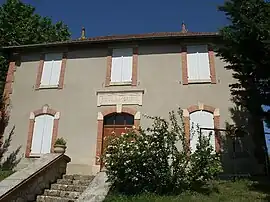 The town hall and school in Gavarret-sur-Aulouste | |
Location of Gavarret-sur-Aulouste | |
 Gavarret-sur-Aulouste  Gavarret-sur-Aulouste | |
| Coordinates: 43°46′21″N 0°39′11″E | |
| Country | France |
| Region | Occitania |
| Department | Gers |
| Arrondissement | Condom |
| Canton | Fleurance-Lomagne |
| Intercommunality | Lomagne Gersoise |
| Government | |
| • Mayor (2020–2026) | Éric Biz[1] |
| Area 1 | 8.38 km2 (3.24 sq mi) |
| Population | 139 |
| • Density | 17/km2 (43/sq mi) |
| Time zone | UTC+01:00 (CET) |
| • Summer (DST) | UTC+02:00 (CEST) |
| INSEE/Postal code | 32142 /32390 |
| Elevation | 94–201 m (308–659 ft) (avg. 199 m or 653 ft) |
| 1 French Land Register data, which excludes lakes, ponds, glaciers > 1 km2 (0.386 sq mi or 247 acres) and river estuaries. | |
Geography

Gavarret-sur-Auguste and its surrounding communes
Population
| Year | Pop. | ±% |
|---|---|---|
| 1962 | 133 | — |
| 1968 | 132 | −0.8% |
| 1975 | 125 | −5.3% |
| 1982 | 132 | +5.6% |
| 1990 | 121 | −8.3% |
| 1999 | 129 | +6.6% |
| 2008 | 133 | +3.1% |
See also
References
- "Répertoire national des élus: les maires". data.gouv.fr, Plateforme ouverte des données publiques françaises (in French). 2 December 2020.
- "Populations légales 2020". The National Institute of Statistics and Economic Studies. 29 December 2022.
Wikimedia Commons has media related to Gavarret-sur-Aulouste.
This article is issued from Wikipedia. The text is licensed under Creative Commons - Attribution - Sharealike. Additional terms may apply for the media files.