Saint-Clair-sur-l'Elle
Saint-Clair-sur-l'Elle (French pronunciation: [sɛ̃ klɛʁ syʁ lɛl], literally Saint Clair on the Elle) is a commune in the Manche department in Normandy in north-western France.[3]
Saint-Clair-sur-l'Elle | |
|---|---|
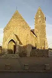 The church of Saint-Clair | |
Location of Saint-Clair-sur-l'Elle | |
 Saint-Clair-sur-l'Elle  Saint-Clair-sur-l'Elle | |
| Coordinates: 49°11′35″N 1°01′42″W | |
| Country | France |
| Region | Normandy |
| Department | Manche |
| Arrondissement | Saint-Lô |
| Canton | Pont-Hébert |
| Intercommunality | Saint-Lô Agglo |
| Government | |
| • Mayor (2020–2026) | Maryvonne Raimbeault[1] |
| Area 1 | 7.99 km2 (3.08 sq mi) |
| Population | 968 |
| • Density | 120/km2 (310/sq mi) |
| Time zone | UTC+01:00 (CET) |
| • Summer (DST) | UTC+02:00 (CEST) |
| INSEE/Postal code | 50455 /50680 |
| Elevation | 12–95 m (39–312 ft) (avg. 55 m or 180 ft) |
| 1 French Land Register data, which excludes lakes, ponds, glaciers > 1 km2 (0.386 sq mi or 247 acres) and river estuaries. | |
See also
References
- "Répertoire national des élus: les maires" (in French). data.gouv.fr, Plateforme ouverte des données publiques françaises. 13 September 2022.
- "Populations légales 2020". The National Institute of Statistics and Economic Studies. 29 December 2022.
- INSEE commune file
Wikimedia Commons has media related to Saint-Clair-sur-l'Elle.
This article is issued from Wikipedia. The text is licensed under Creative Commons - Attribution - Sharealike. Additional terms may apply for the media files.