Le Brugeron
Le Brugeron (French pronunciation: [lə bʁyʒʁɔ̃]) is a commune in the Puy-de-Dôme department in Auvergne-Rhône-Alpes in central France.
Le Brugeron | |
|---|---|
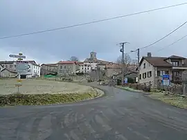 A general view of Le Brugeron | |
.svg.png.webp) Coat of arms | |
Location of Le Brugeron | |
 Le Brugeron  Le Brugeron | |
| Coordinates: 45°42′46″N 3°43′11″E | |
| Country | France |
| Region | Auvergne-Rhône-Alpes |
| Department | Puy-de-Dôme |
| Arrondissement | Ambert |
| Canton | Les Monts du Livradois[1] |
| Government | |
| • Mayor (2020–2026) | Roger Dubien[2] |
| Area 1 | 27.42 km2 (10.59 sq mi) |
| Population | 243 |
| • Density | 8.9/km2 (23/sq mi) |
| Time zone | UTC+01:00 (CET) |
| • Summer (DST) | UTC+02:00 (CEST) |
| INSEE/Postal code | 63057 /63880 |
| Elevation | 671–1,427 m (2,201–4,682 ft) (avg. 817 m or 2,680 ft) |
| 1 French Land Register data, which excludes lakes, ponds, glaciers > 1 km2 (0.386 sq mi or 247 acres) and river estuaries. | |
Population
| Year | Pop. | ±% p.a. |
|---|---|---|
| 1990 | 359 | — |
| 1999 | 274 | −2.96% |
| 2007 | 267 | −0.32% |
| 2012 | 251 | −1.23% |
| 2017 | 245 | −0.48% |
| Source: INSEE[4] | ||
References
- "Décret 2014-210 du 21 février 2014 portant délimitation des cantons dans le département du Puy-de-Dôme" [2014-210 decree delimiting cantons of Puy-de-Dôme department]. Légifrance (in French). 21 February 2014.
- "Répertoire national des élus: les maires". data.gouv.fr, Plateforme ouverte des données publiques françaises (in French). 2 December 2020.
- "Populations légales 2020". The National Institute of Statistics and Economic Studies. 29 December 2022.
- Population en historique depuis 1968, INSEE
Wikimedia Commons has media related to Le Brugeron.
This article is issued from Wikipedia. The text is licensed under Creative Commons - Attribution - Sharealike. Additional terms may apply for the media files.