Langeac
Langeac (French pronunciation: [lɑ̃ʒak]; Occitan: Lanjac) is a commune in the Haute-Loire department in south-central France. It is located about 30 km west of Le Puy-en-Velay, and about 100 km southwest of Lyon.
Langeac | |
|---|---|
Commune | |
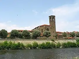 The river Allier and the Saint Gal Collegiate church. | |
 Coat of arms | |
Location of Langeac | |
 Langeac  Langeac | |
| Coordinates: 45°06′04″N 3°29′42″E | |
| Country | France |
| Region | Auvergne-Rhône-Alpes |
| Department | Haute-Loire |
| Arrondissement | Brioude |
| Canton | Gorges de l'Allier-Gévaudan |
| Government | |
| • Mayor (2020–2026) | Gérard Beaud[1] |
| Area 1 | 33.94 km2 (13.10 sq mi) |
| Population | 3,451 |
| • Density | 100/km2 (260/sq mi) |
| Time zone | UTC+01:00 (CET) |
| • Summer (DST) | UTC+02:00 (CEST) |
| INSEE/Postal code | 43112 /43300 |
| Elevation | 488–951 m (1,601–3,120 ft) |
| 1 French Land Register data, which excludes lakes, ponds, glaciers > 1 km2 (0.386 sq mi or 247 acres) and river estuaries. | |
Population
|
|
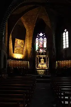
church interior
References
- "Répertoire national des élus: les maires" (in French). data.gouv.fr, Plateforme ouverte des données publiques françaises. 13 September 2022.
- "Populations légales 2020". The National Institute of Statistics and Economic Studies. 29 December 2022.
Wikimedia Commons has media related to Langeac.
This article is issued from Wikipedia. The text is licensed under Creative Commons - Attribution - Sharealike. Additional terms may apply for the media files.